Jeff Kent is the author of a new guidebook, Southern England’s 1,000-Foot Peaks. In this feature he shares three walks reaching some of the best of these summits
Southern England’s 1,000-Foot Peaks is the first-ever published guide to the 408 hills of the reason that reach the magic mini-mountain four-figure height, and is the first volume of a projected series of tomes covering England’s 1,000-foot peaks. The author, Jeff Kent, has collectively named them The Kents.
All of the peaks are described in detail, with comments on their main features, including their shapes, slopes, prominences, subsidiary physical features, river sources, woodlands, trig points, prehistoric and historic sites, existing settlements, and more.
We asked the author to share three walks that reach the best of these summits.
Rough Tor and Brown Willy, Cornwall
Start/finish: Roughtor Road car park, near Camelford, Cornwall
A circular four-mile walk to the summits of Cornwall’s highest peak and one of its most spectacular, in the midst of prehistoric remains.
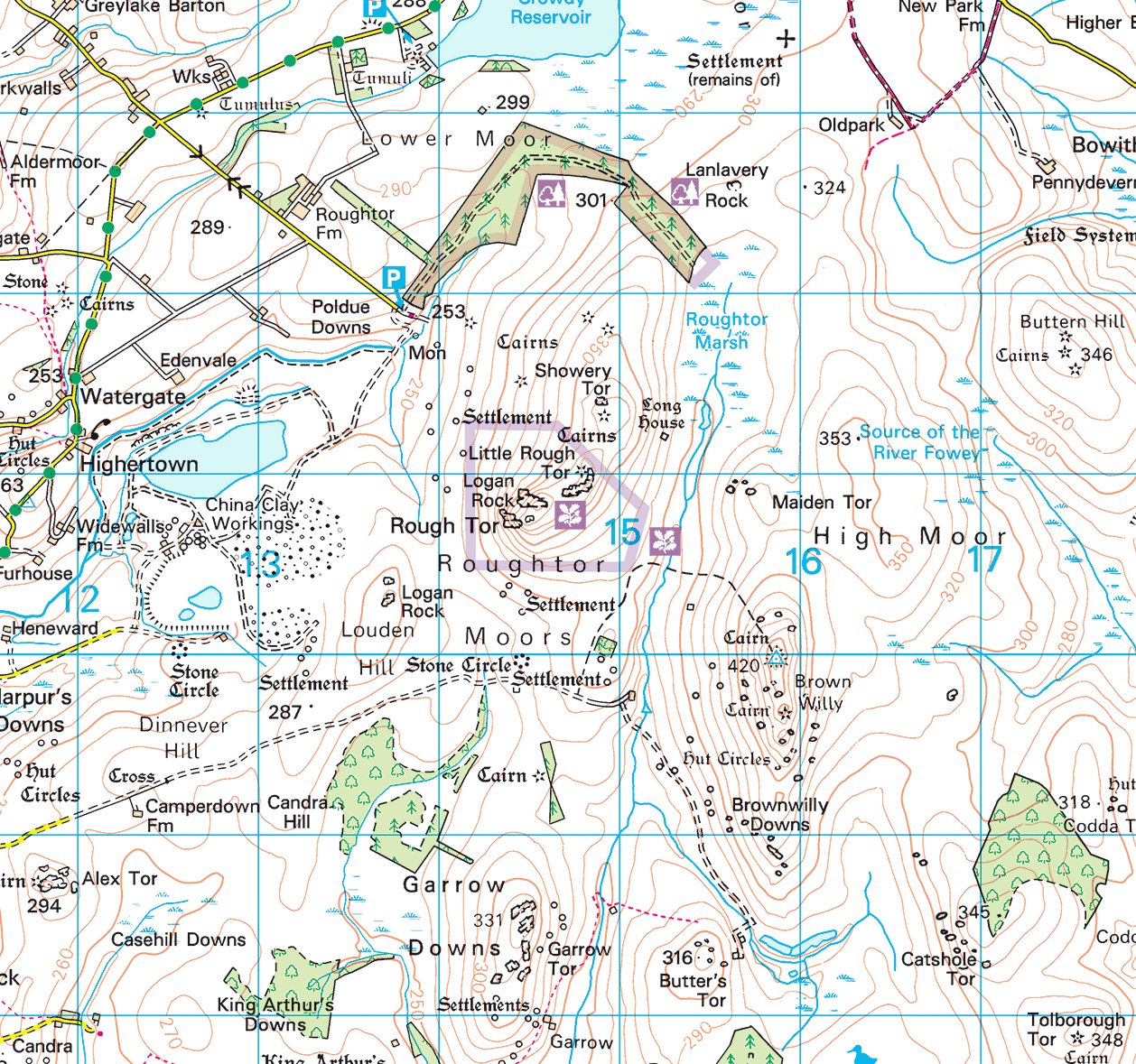
Park at the southeastern end of Roughtor Road (SX 138818), at the OS maps’ parking symbol. The spectacular Rough Tor ridge can be seen to the south-southeast.
Initially, a track to the east-southeast is followed and crosses a stream. The track peters out and a non-OS marked footpath is then taken quite gently up to the bottom of the Rough Tor ridge. Its southern and highest end should be aimed for. The ascent route becomes more rocky and steeper, but is no problem for hill walkers.
Its summit rocks (SX 145808) are at the southern end of the ridge, but the whole of it (including Little Rough Tor and Showery Tor beyond), with its fabulous rock tors, can be explored with ease.
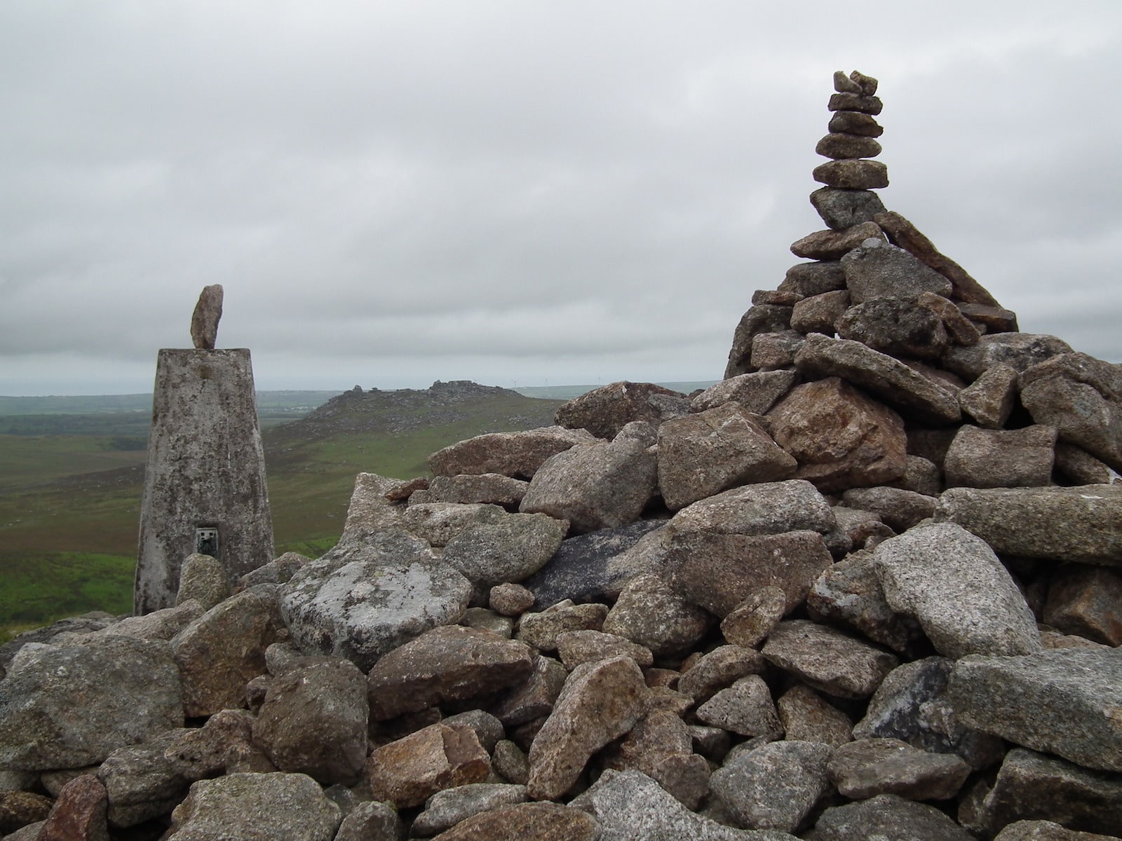
From the summit, the descent is to the east-southeast to cross the De Lank River (SX 152804) and an OS track and then footpath are taken steadily up to the cairn and trig point summit of Brown Willy (SX 158799), Cornwall’s highest peak. Its ridge, to the south, can also be explored and the views (as from Rough Tor) are excellent.
The route then returns to the De Lank River bridge and from there strikes north-northwest, to pass westwards between Little Rough Tor and Showery Tor (SX 149813). A detour, just to the north, can be taken to the summit of the latter and its prehistoric cairn. A path then leads broadly north-northwest back to the starting point.
Brent Tor, Devon
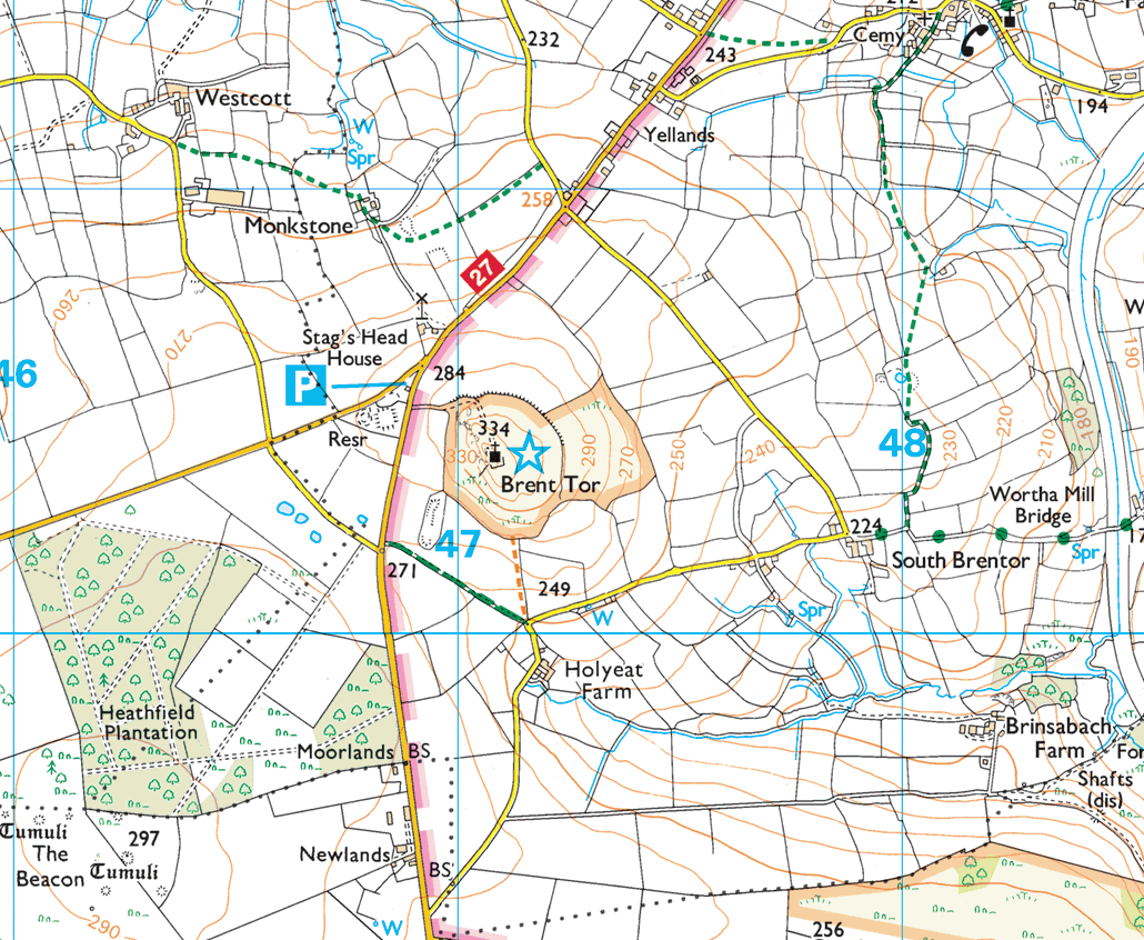
Start/finish: Holyeat Farm, near Tavistock, Devon
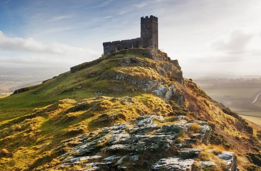
Devon’s impressive, isolated and most westerly 1,000-foot hill is easily climbed on a permissive footpath from a minor road by Holyeat Farm (SX 471800). It rises fairly steadily and then more steeply northwards onto access land. At its summit is the commanding St Michael’s Church (SX 470804), from where the views are spectacular. The descent is by the same route. The round trip is approximately half a mile.
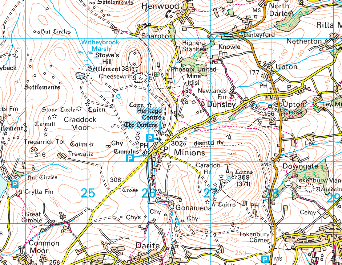
Stowe’s Hill and the Cheesewring
Start/finish: Minions, Cornwall
A fascinating 2¾-mile circular walk packed with prehistoric remains and fascinatingly-shaped rock tors, starting and finishing in Minions, Cornwall’s highest village.
There are several parking places, including car parks, in the village.
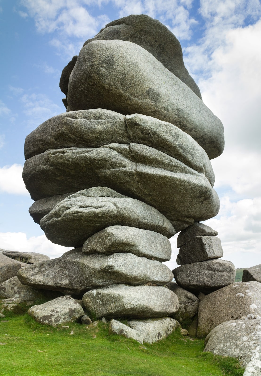
From its centre, take a very minor road north-northeast (SX 260711). This quickly becomes a track and soon the three Hurlers stone circles are seen. The route continues and gradually ascends on a track which was formerly a mineral railway. This reaches a disused quarry (SX 259722), which can be circumvented to the west to reach the remarkable Cheesewring tor and the summit of Stowe’s Hill (SX 257724), within its Neolithic enclosures.
The descent is initially south to a track (SX 257722), which needs to be taken to the west. It curves to the south and passes the two Pipers standing stones (SX 257713) on its way back to Minions.
Signed copies of Southern England’s 1,000-Foot Peaks by Jeff Kent are available from Witan Books.
Header image: Brent Tor

