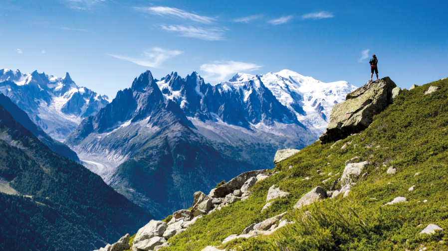
Three nations, one soul, 170 kilometers of walk, 10,000 meters of elevation. The Tour du Mont Blanc is the walk of a lifetime – no matter your starting point.
The Tour du Mont Blanc is a spectacular trekking itinerary that winds around the Mont Blanc massif, crossing the Italian, Swiss and French territories. The way is populated by charming mountain towns which make great pitstops for rest days. While many begin in Chamonix, you can walk the Tour du Mont Blanc from Courmayeur, Italy at its peak.
Looming glaciers and long gravely moraines, majestic peaks that wrote the history of mountaineering, pastures, green grasslands, and traditional alpine villages: Tour du Mont Blanc is an adventure that will lead you close to the mountain, with its rhythms and its silence, its scents and colours. Along the way, you’ll get to admire several enchanting views of the highest mountain range in Europe, every day.
Start/end: Courmayeur, Italy | Length: 165km / 100 miles | Ascent: 8,917m | Season: June – September | Difficulty: Medium | Duration: 10 – 12 days
Here, our friends at Courmayeur Mont Blanc take you step-by-step through the stages.
STAGE 1: Courmayeur – Rifugio Bonatti Hut
Altitude difference: D+ 1,094 mt
Length: 12,05 km
Estimated time: 5h
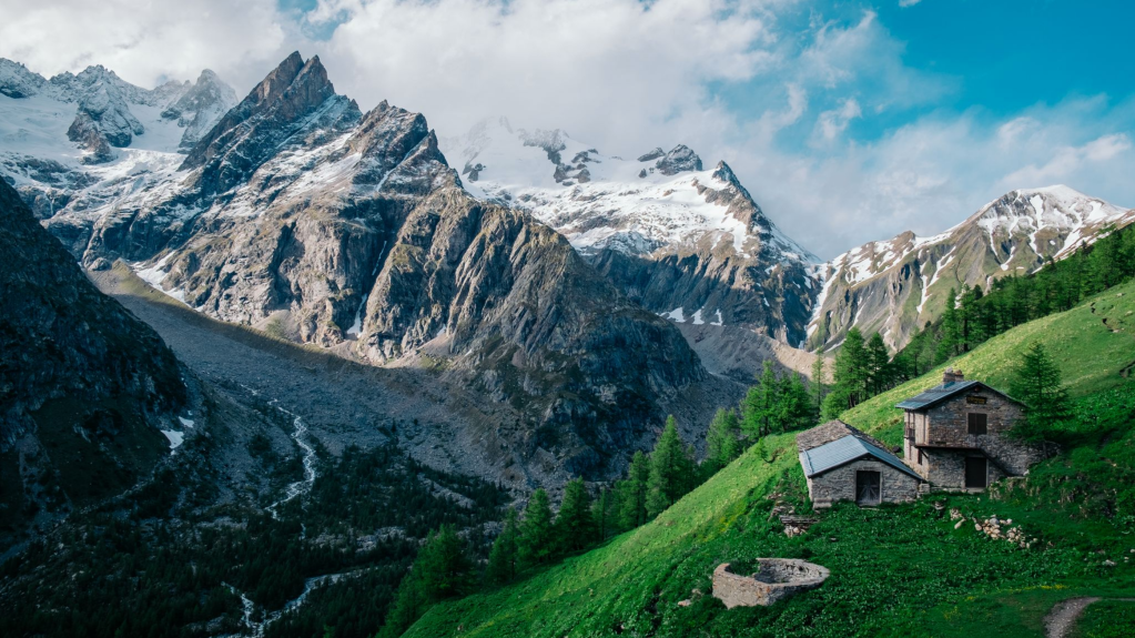
The first stage includes an initial long climb from the slopes of Mont de la Saxe to Rifugio Bertone, from which then begins the ” Val Ferret Balcony”, a long and pleasant flat path that leads to Rifugio Bonatti, leaving the gaze free to wander over the majesty of Mont Blanc and the entire Val Ferret at its feet.
Rifugio Bertone. Credit: Courmayeur Mont Blanc
STAGE 2: Rifugio Bonatti Hut – Rifugio Elena Hut
Altitude difference: D+ 382 mt
Length: 7,48 km
Estimated time: 2h 50′
A second short stop to allow an adequate recovery time at the beginning of the adventure, to lead the last route of the Val Ferret Balcony, and start the ascent to Col Ferret that will lead to cross the first border with Switzerland.
STAGE 3 : Elena Refuge Hut – La Fouly
Altitude difference: D+ 503 mt
Length: 11.22 km
Estimated time: 4 h 40′
You enter the Swiss territory crossing the Col Ferret, crossing the Swiss side of the Val Ferret through pastures and bucolic landscapes.
Two walkers looking into Val Ferret. Credit: Courmayeur Mont Blanc
STAGE 4: The Fouly – Champex
Altitude difference: D+ 515 mt
Length: 14,91 km
Estimated time: 5h
Often traveled by public transport by those who do not have enough time, this stage runs at low altitudes, through landscapes in which it seems that time has stopped. Relaxing stage, in view of the climb to the highest altitude of the following day.
STAGE 5: The Champex – Le Peuty
Altitude difference: D+ 1.225 mt
Length: 12,93 km
Estimated time: 6h 40′
The fifth stage leads to the highest altitude of the Tour du Mont Blanc with the ascent to the Fenêtre D’Arpette. In case of adverse weather conditions, it is always advisable to avoid this climb by opting for the variant of Bovine.
STAGE 6: Le Peuty – Montroc
Altitude difference: D+ 1,096 mt
Length: 13,80 km
Estimated time: 6h 35′
Crossing the Col de Balme, with the entry into French territory, the summit of Mont Blanc returns to stand in the sky.
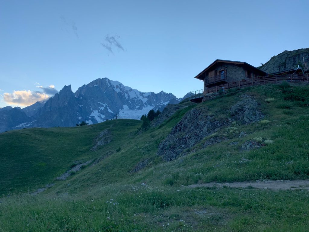
Huts on the Tour du Mont Blanc. Credit: Shutterstock
STAGE 7: Montroc – La Flégère
Altitude difference: D+ 1.035 mt
Length: 8,60 km
Estimated time: 4h 45′
The seventh stage offers the best views of the Mont Blanc massif in the north. At the foot of the Aiguilles Rouges you cross the nature reserve with magnificent views of the Aiguille Verte, the Mer de Glace, and the north of Les Grandes Jorasses that frame the summit of Mont Blanc. Noteworthy are the equipped passages of the Aiguilette d’Argentière, easily surmountable.
STAGE 8: The Flégère – Les Houches
Altitude difference: D+ 935 mt
Length: 16,92 km
Estimated time: 5h 45′
The spectacular views continue on the northern side of the massif, with the ascent to 2,525 meters of the Brévent as an indelible reminder of the day. This point has been considered one of the best places to observe Mont Blanc since 1700. The views will help you cope with more serenity on the long descent to Les Houches.
STAGE 9: Les Houches – Les Contamines
Altitude difference: D+ 1,494 mt
Length: 18,46 km
Estimated time: 5h 20′
We move away from the village of Chamonix entering the western side of Mont Blanc. Points of interest are the views over the ice wall of the Aiguille de Bionnassay and further away from the Dômes de Miage. Possibility to use the cable car to Col de Voza and avoid a long climb, saving a bit of energy in view of the next stage.
STAGE 10: Les Contamines – Les Chapieux
Altitude difference: D+ 1.353 mt
Length: 18,16 km
Estimated time: 6h
The tenth stage, one of the longest of the entire Tour, greets the Valley of Les Contamines-Montjoie following the ancient route of Roman origin that goes up to the Col du Bonhomme. It is necessary to pay tribute, adding a stone to the heap that meets just before reaching the Col du Bonhomme, to the ladies and her bridesmaid who, according to a legend, lost their lives during a snowstorm at that point.
STAGE 11: Les Chapieux – Elizabeth Refuge
Altitude difference: D+ 975 mt
Length: 13,99 km
Estimated time: 5h
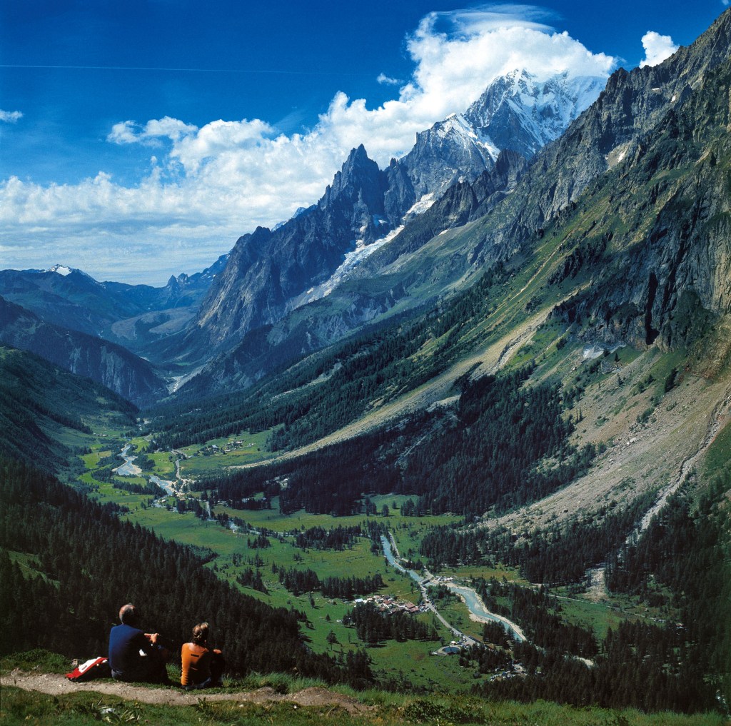
The eleventh stage takes you back to Italy crossing the border of the Col de la Seigne, from which you can appreciate the most celebrated views of the entire adventure: the Pyramides Calcaires, the pastures of the Lex Blanche and the schist slopes of Mont Fortin and Mont Percé to frame the summit of Mont Blanc, the Aiguille Noire de Peutérey, the Dente del Gigante and les Grandes Jorasses.
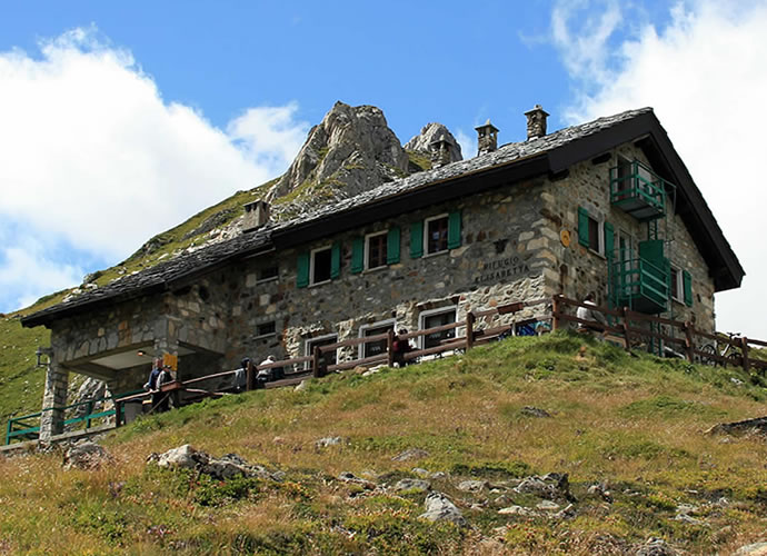
Rifugio Elisabetta. Credit: Courmayeur Mont Blanc
STAGE 12: Rifugio Elisabetta Hut – Courmayeur
Altitude difference: D+ 518 mt
Length: 15,97 km
Estimated time: 5h 40′
The spectacular epilogue of this adventure around Mont Blanc, along the path known as the ” Val Veny Balcony”, offers enchanting views of the glaciers of Miage and Brenva, with the obelisks of Aiguille Noire du Peuterey, The Pylons and the Freney and Brouillard.
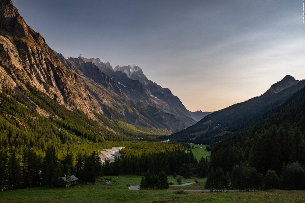
Val Veny at sunset. Credit: Courmayeur Mont Blanc
Useful tips for trekking the Tour du Mont Blanc from Courmayeur
- According to the regional law it is forbidden to set up tents and camp below 2500m.
- Remember to leave the paths as you found them: collect your waste, you can throw them and differentiate once you return to the valley.
- In the mountains, you need appropriate clothing: bring with you sunscreen, a windbreaker, and hiking shoes.
- Keep a trail map in your backpack in case you lose your phone line.
- Always consult the weather conditions before organising your trip.
- There are no refreshment points or fountains along some of these routes. Remember to always bring the right amount of water with you.
- To ensure safety for the youngest hikers, it is advisable to walk along the paths on the side of the mountain.
- Given the presence on the trail of other hikers, but also marmots, squirrels, and other components of the local fauna, it is recommended to keep dogs on a leash.
Learn more about this ‘place above ordinary’ at www.courmayeurmontblanc.it.