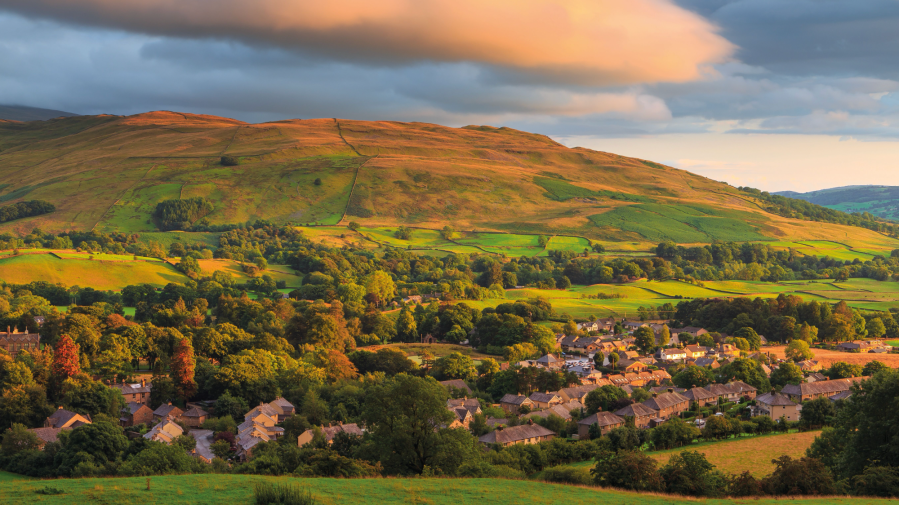
There’s more to England’s official book town of Sedbergh than can be contained within paper pages, says Vivienne Crow.
If you’re a hillwalker and you’ve come to Sedbergh, you’re here for the Howgills. Step out of the door of any B&B or holiday cottage and you’re never more than a 15-minute walk from a path leading directly up into this compact group of hills. So, to use an often-misused cliché, it really does sit ‘at the foot’ of the fells.
Main image: Sunrise over Sedbergh | Credit: Shutterstock
Part of Cumbria but contained within the 2016 extension of the Yorkshire Dales, the Howgills have a character that sets them apart from the rest of the National Park. Smooth, rounded tops form a great dome, rising to a high point of 676m on The Calf, which enjoys views of the North Pennines, the main part of the Yorkshire Dales and the Lake District’s high central fells. The range’s long, whaleback ridges are divided by steep-sided valleys that hide a few rockier rarities in this otherwise grassy landscape, including the massive waterfall of Cautley Spout and the narrow ravine of Carlin Gill.
It’s not a big range; you could easily tick off all the main summits in one weekend if you wanted. It’s little more than eight miles from Sedbergh at the southern foot of the group to Bowderdale in the north. From east to west, at its widest point, it’s about seven miles. And there’s very little to hold you back; no walls nor fences, no crags to surmount and hardly any bog, peat hags or heather.
While in Sedbergh, find some time to wander its lovely lanes and alleyways; maybe stroll over to the historic buildings of the public school, established in 1525. It’s only a tiny town, so it won’t take long unless, of course, you get distracted by the book shops… This is England’s official ‘book town’.

Sedbergh, with the Howgills rising behind homes and businesses. Credit: Vivienne Crow
Your weekend in Sedbergh, sorted
- The weekend itinerary
- Other walks near Sedburgh
- Accommodation
- Food and drink
- Guides and activity providers
- Guidebooks
- Getting there
Your itinerary
Saturday
The Calf. That’s where you’ll be aiming for. No matter where you start your walk, if you’re planning a long day on the Howgills, you will almost certainly reach The Calf at some point. From Sedbergh, one of the best full-day walks follows the Dales High Way up to the trig pillar on this central point of the dome-like group. Grass underfoot makes for easy walking all the way, so bypassing Arant Haw on the way up seems like sacrilege. Calders is the next top, and from here the scene to the north suddenly joins the unfurling, far-reaching views. Leaving the Dales High Way at The Calf, head north-west to Breaks Head and then on to Fell Head.
It’s now time to start thinking about the return to Sedbergh. A quiet lane skirts the western base of the Howgills for a steady, but long plod back to town, or you could negotiate largely pathless ground above the intake wall to avoid the road. Depending on the route chosen, expect to cover about 18km with 900m of ascent – probably not much more than about six hours of hiking. If you’ve got time after your walk, pop into Westwood Books, which occupies two floors of a former cinema on Long Lane. Grab a coffee, select a book from its selection of 70,000 titles and find a cosy corner to settle down in.
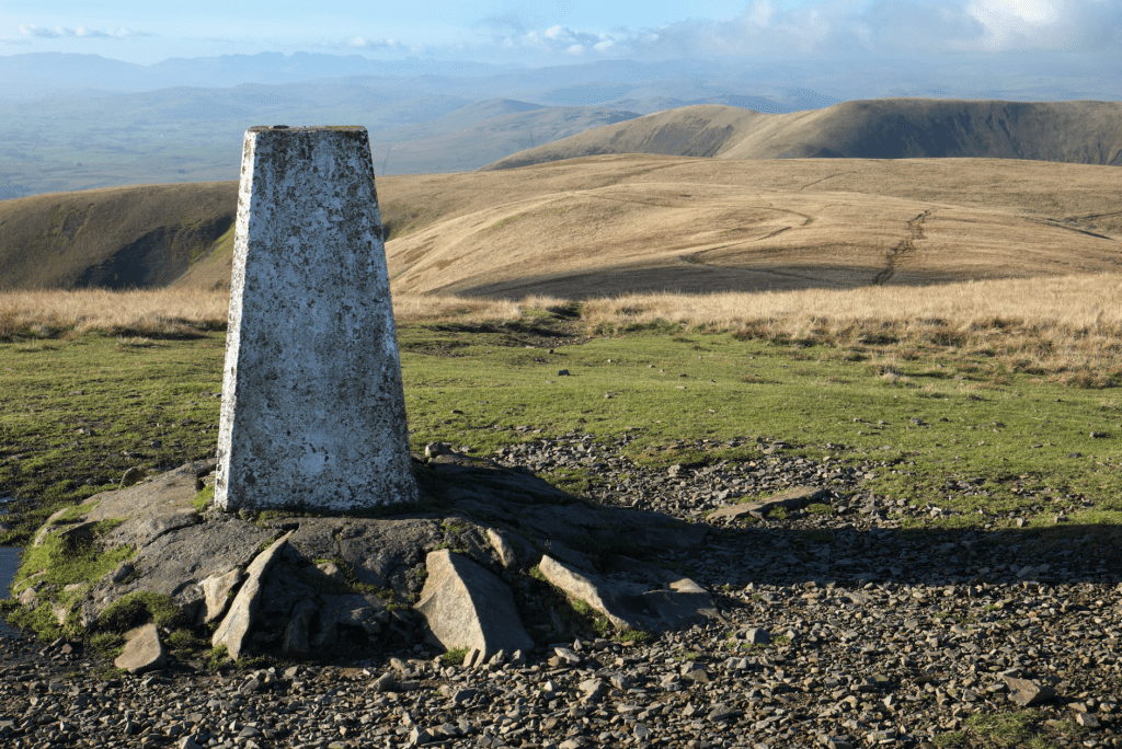
The Calf, the highest point on the Howgills Fells. Credit: Vivienne Crow
Sunday
While you won’t have encountered Lake District-like crowds climbing The Calf from Sedbergh, approaching it from the north, via Cumbria’s ‘other’ Langdale, will be even quieter. From near the point at which Langdale Beck enters the River Lune at Gaisgill, it can be followed upstream, through rough pastureland and up between incredibly smooth, steep-sided hills to the point at which it splits into ‘grains’ originating from the northern flanks of The Calf. Simon’s Seat, Bleagill Head, Stowgill Brow and Bush Howe are climbed on the way up to the trig pillar.
Returning along the long, whaleback ridge that The Calf throws out to the north – taking in West Fell – it’s almost possible to fool yourself into thinking the hills go on forever, that northern England is a place of unending uplands and little else. The full circuit is 21km with about 950m of ascent, and is likely to take about seven hours.
On your way back to Sedbergh, call in at the Cross Keys Inn at Cautley on the A683. Located in a pretty spot at the eastern base of the Howgills, this is the only pub in England without a licence to sell alcohol. It became a temperance inn in 1902 and was then bequeathed to the National Trust as an unlicensed inn.
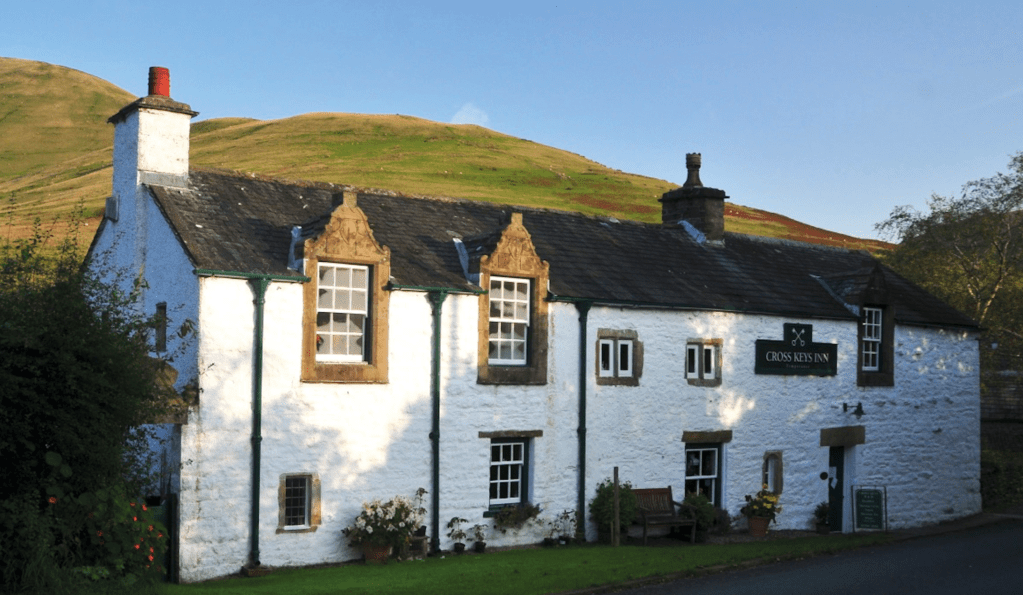
The Cross Keys – the unique 17th century temperance inn at the start of the walk. Credit: Roger Butler
Other walks nearby
Cautley Spout and Crag
Distance: 6 miles/9.7km | Ascent: 1900ft/579m | Duration: 3.5 hours
A layby near the Cross Keys is the jumping-off point for walks up to Cautley Spout. This series of cascades plummets almost 200 metres from the high plateau above and, depending on how you measure your waterfalls, is the longest drop of any in England. Clamber up the steep ground to the north of the falls and then head over the top of Cautley Crag before dropping back to the valley via Fawcett Bank Rigg. The River Rawthey is then followed back to Cautley.
Winder
Distance: 4 miles/6.4km | Ascent: 1140ft/348m | Duration: 2 hours
The short walk up to Winder makes for a great evening outing or as a way to stretch your legs before your journey home. Follow Howgill Lane out of Sedbergh and then join an old track leading to the western base of the fell. A grassy path, typical of what you’ll have, by now, come to expect of the Howgills, leads to the toposcope and trig pillar on the 473m summit. It’s all about those views.
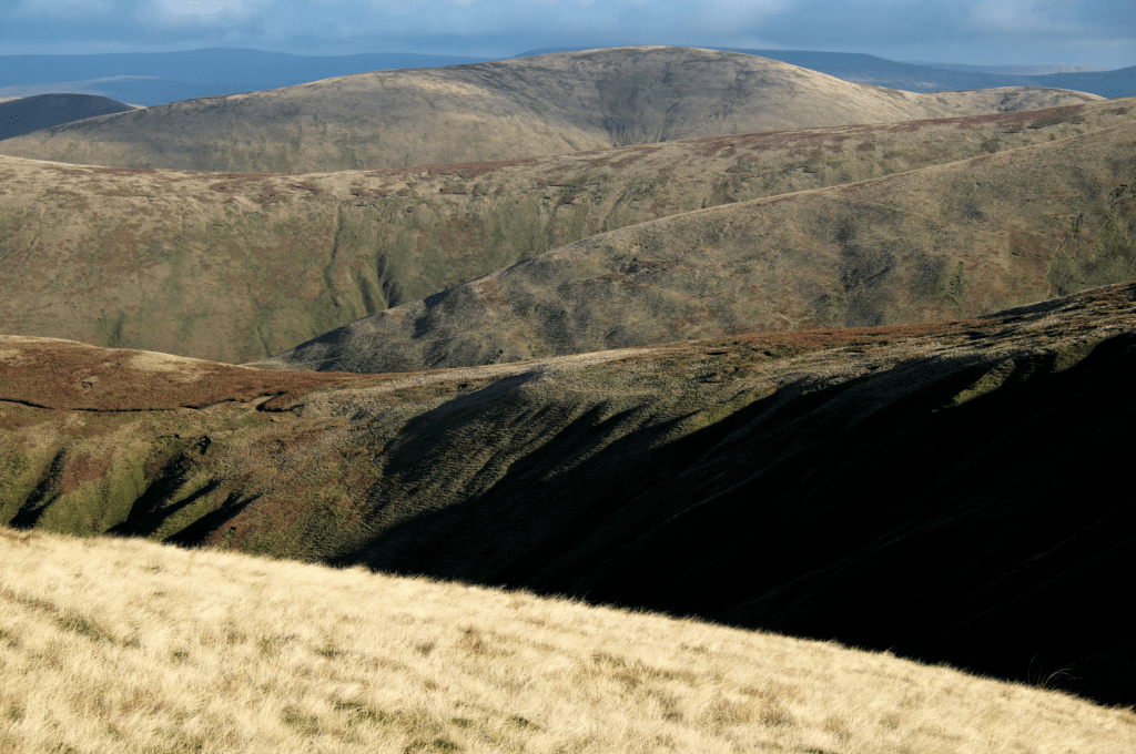
Long ridgelines are typical of the Howgills. Credit: Vivienne Crow
Accommodation in Sedbergh
The town’s pubs provide accommodation as do a few smaller B&Bs. The nearest campsites are Pinfold Caravan Park on the A684 and Farm and Fell Campsite on Birks Lane, both less than one mile from the town centre.
Food and drink
The Black Bull is the place to go in Sedbergh. Combining her Japanese/German heritage with the best that local producers have to offer, head chef Nina Matsunaga serves up award-winning dishes such as trout with preserved ramson and miso. If you can’t get in – and tables do get booked up fast at weekends – try The Dalesman, just a few doors down on Main Street.
Guides and activity providers
Into the Outside organises guided walks, gill scrambling, mountain biking and wild swimming in the Howgills (07748 764640/07966 140649)
Operating in the Yorkshire Dales and the Lake District, this company offers private guided walks (01524 271580)
This group accommodation provider in nearby Cautley works with several qualified Mountain Leaders in the area (01539 620287)
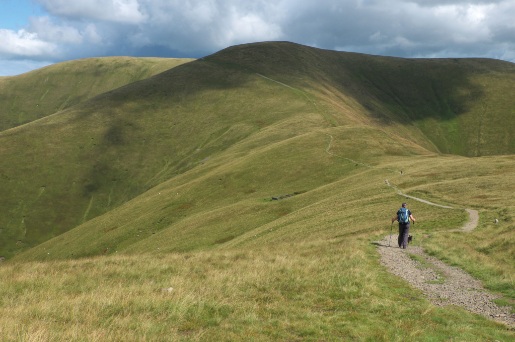
Ridge path climbs towards Calders in the Howgills. Credit: Vivienne Crow
Guidebooks
One of the best guides to the area is Dennis and Jan Kelsall’s The Lune Valley and Howgills (Cicerone, £12.95), which covers both hill and valley routes. In 2022, the Wainwright Society republished Wainwright’s Walks on the Howgill Fells, revised by Chris Jesty.
Getting there
If you’re driving, reaching Sedbergh is relatively easy; it’s less than five miles from junction 37 on the M6. Things get trickier if you’re coming by public transport. There are a few buses linking the town with Oxenholme on the West Coast Main Line and with Kirkby Stephen Station on the Settle to Carlisle Railway, but services do not operate on Sundays.
Discover more of the UK adventure towns and villages that make great weekend bases from which to explore the hills.

