Vivienne Crow guides you to an area dotted with national trails and recreational paths above ground – and riddled with subterranean treasures if you know where to look.
Horton in Ribblesdale has long been at the heart, both literally and figuratively, of northern England’s hill-walking country. This is where, for decades, Pennine Way hikers have rested their weary bodies between Malham and Hawes; and it’s from where challenge walkers have traditionally set off on the Yorkshire Three Peaks – up until a few years ago by downing a huge mug of milky instant coffee before using an old-fashioned clocking-in machine in the village café to record their start times. With the village also being on the route of the Pennine Journey and the Ribble Way, and the Dales High Way and Pennine Bridleway passing close by, the Ordnance Survey’s Explorer map OL2 is chockfull of the green diamonds representing ‘National Trails and recreational paths’.
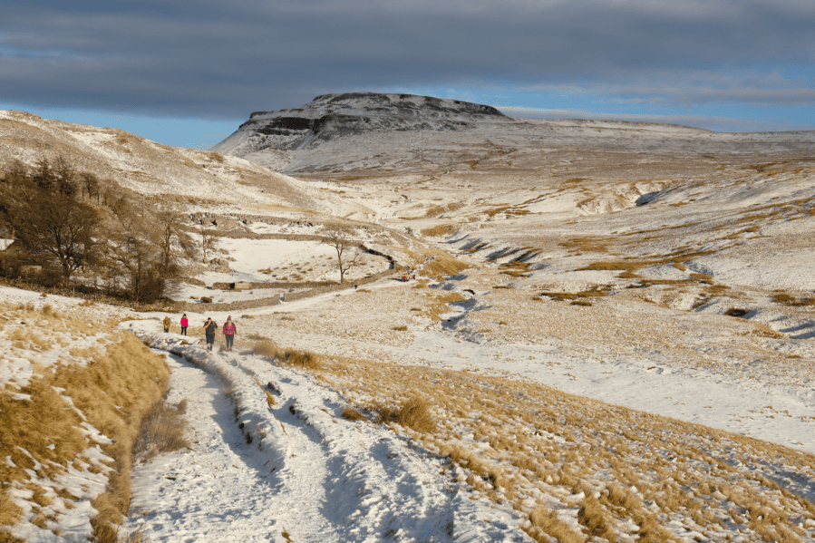
Main image: Walking to Ingleborough | Credit: Shutterstock
Horton is also where people come to explore the limestone country of the south-western Yorkshire Dales, one of the most fascinating geological landscapes found in these islands. Gaping chasms, clints and grikes, dry ravines, caves, vanishing streams, the sound of subterranean becks flowing, unseen, somewhere far below your feet…
It’s not a massive village – it has a population of little more than 400, occupying a combination of 17th-century farmhouses and 19th-century cottages in an attractive, riverside location squeezed between Pen-y-ghent and Ingleborough – but it can seem a lot bigger on summer weekends when fields have to be turned into temporary car parks to cope with the influx of walkers. So, for those who’d rather avoid the crowds, winter’s a good time for visiting. Should the weather turn nasty, there’s always the Settle to Carlisle Railway – opening up opportunities for sight-seeing further afield.
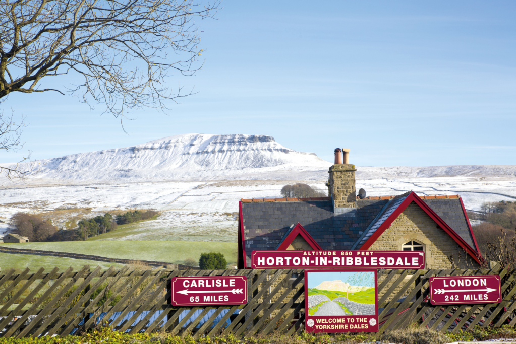
The station takes you back in time. Credit: Shutterstock
Your weekend in Horton in Ribblesdale, sorted
- The weekend itinerary
- Other walks near Horton in Ribblesdale
- Accommodation
- Food and drink
- Guides and activity providers
- Guidebooks
- Getting there
Your itinerary
Saturday
Nowhere is it written in tablets of stone that thou must walk all of the Three Peaks in one day. Yes, it’s good when you need a challenge, and the achievement of course comes with its bragging rights, but we’re here for a relaxing weekend, aren’t we? If we’re agreed on that, then day one has to be Pen-y-ghent. Horton and Pen-y-ghent go together like Zermatt and the Matterhorn, or Cape Town and Table Mountain. Look out of the window of your B&B, open the zip on your tent, and it’s there – its distinctive, tiered profile begging you to come out and play.
It can be attempted in a relatively short day of about 9km – ideal if the winter weather is closing in – but the 14km route taking in neighbouring Plover Hill as well is more satisfying. Starting from Horton itself, the route gently ascends grassy fields divided by the silvery-grey dry-stone walls of limestone country. Joining the route of the Pennine Way, we then tackle the hill’s steep, rocky nose. There are two stages to the climb proper. The first steep section makes use of a convenient rocky staircase created by bands of limestone. A natural shelf then provides an opportunity to enjoy the views (aka have a rest) before the second, more challenging gritstone rockstep.
Beyond the trig pillar, quieter walking country awaits as the route heads across the moorland of Plover Hill and then drops to an excellent bridleway at the base of the hill. The chasm of Hull Pot is passed before a green lane drops back into the village.
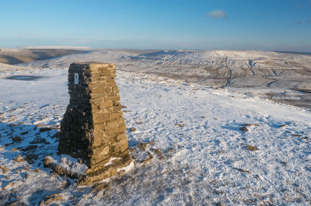
The trig point atop Pen-y-Ghent. Credit: Shutterstock
Sunday
If it’s Sunday, then it must be Ingleborough… It’s not always apparent from Horton, but Pen-y-Ghent and Ingleborough are practically twins. While vistors’ eyes can’t fail to be drawn to Pen-y-Ghent’s distinctive outline looming over the village, you’d be forgiven for thinking that Ingleborough is less impressive. In fact, it’s hiding its best side – its north face, where a formidable jumble of crags, scree and shattered boulders forms a tiered outline that is similar to the one on Pen-y-ghent but on a grander scale.
There are various ways to reach the 724m summit from Ribblesdale. A direct route heads through Sulber Nick and continues straight up to the plateau via the Swine Tail path. Better still, after Sulber Nick, detour south-west to approach via the narrow limestone ravine of Trow Gill and then Gaping Gill, where Fell Beck disappears into a massive hole in the ground, dropping 100m into one of Britain’s largest underground caverns.
Once you’re reached the top, you have a choice: there’s the direct route back down for a 16km circular walk or you could continue north-east along a moorland ledge, later descending to Ribblehead Station for an 18km linear using the Settle to Carlisle Railway. And, if you’ve got time before the train back to Horton, have a wander down to the famous viaduct to take in the scale of this towering feat of engineering.
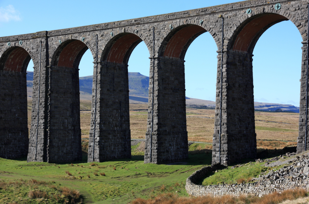
The Ribblehead viaduct. Credit: Vivienne Crow
Other walks nearby
Whernside
Distance: 13.6 miles/22km | Ascent: 1920ft/585m | Duration: 6.5 hours
To experience the best that Yorkshire’s highest hill has to offer, catch the train to Ribblehead and then head out across the limestone pavement of Scales Moor with its delicately balanced boulders and gritstone erratics. Whernside can then be climbed via West Fell and descended via the secluded Whernside Tarns and Dales High Way.
Limestone Country
Distance: 8.5 miles/13.7km | Ascent: 1050ft/320m | Duration: 3.5 hours
For a gentler half-day, the limestone features to the north of Horton can be explored using the paths and green lanes of the Pennine Way and Three Peaks route. Sell Gill Holes, Birkwith Cave, Calf Holes, Jackdaw Hole, Hull Pot and Hunt Pot are just a few of the limestone fissures providing access to the subterranean world. Peer in and wonder!

Inside Gaping Gill. Credit: Shutterstock
Accommodation in Horton in Ribblesdale
Both of the village pubs, The Crown and the Golden Lion, offer accommodation, and there are several B&Bs. For the hardy, Holme Farm Campsite is open all year although you won’t find any staff on site at Christmas or New Year. There’s also a bunkhouse, the Three Peaks Bunkroom, next to the Golden Lion.
Food and drink
Leave your glad rags at home; there’s no fine dining in Horton in Ribblesdale. What you will find though are the hearty pub classics – steak pie and chips, home-made lasagne, shoulder of lamb – that are perfect for refuelling after a cold day on the hills. There are no shops in Horton, so those who are self-catering will need to stock up in Settle, which is about six miles away.
Guides and activity providers
Based in nearby Ingleton, this activity provider organises caving, canyoning, ghyll scrambling, climbing and abseiling (07884 260815 / 07909 223819)
Mountain Leader and Royal Geographical Society Fellow, Mark offers navigation courses among his various programmes (07711 264019)
Caving adventures and instruction for all abilities, from an introductory level to advanced skills for experienced potholers (01729 824455)

On the approach to Pen-y-Ghent. Credit: Vivienne Crow
Guidebooks
This part of the National Park is covered in Dennis and Jan Kelsall’s walking guidebook Yorkshire Dales: South and West (Cicerone, £12.95). The 44 routes in the book cover hills and dales, and range from 6km strolls to the full Three Peaks circuit.
Getting to Horton in Ribblesdale
The best way to reach Horton in Ribblesdale is undoubtedly via the Settle to Carlisle Railway, with direct trains continuing south from Settle to Leeds. The total journey time from Leeds to Horton is roughly 70 minutes. By car, the village is about 60km from junction 31 (Preston) on the M6.
Discover more of the UK adventure towns and villages that make great weekend bases from which to explore the hills.

