With towering fells and tarns a-plenty, our Wild Walks experts map out their pick of the best Lake District walks so you can enjoy this national park to its fullest.
Lakeland: the home of England’s highest peak, Wainwright’s 214 fells, market towns such as Ambleside and Keswick, historic caves, rural community, excellent pubs and fine dining as well as more swim spots than you can shake a soggy DryRobe at. This small but mighty Cumbrian national park can cause option paralysis and planning a trip can feel a little overwhelming at times, especially if you’re travelling from afar and squeezing walks into good weather windows. So, where to begin? We asked our experts, many of who hail from Lakeland and call its hills home, to share what they think are the best Lake District walks. They’ve also mapped the routes for you.
Main image: Scrambling Jack’s Rake | Credit: James Forrest
Before you head out on any graded routes, check out our beginners’ guide to scrambling.
The TGO Wild Walks experts’ pick of the best Lake District walks – plus route maps
- Jack’s Rake, Pavey Ark
- Scafell Pike via Esk Hause
- The Gatesgarth Round
- The Dodds Round
- Skiddaw via Lingy Hut
- The Fusedale Round
- The Deepdale Horseshoe
- Blencathra via Sharp Edge
- Shamrock Traverse
- Yewbarrow
1. Jack’s Rake, Pavey Ark
If you’re looking to add a touch of adventure and adrenaline to your Langdale Pikes hike – already one of the best Lake District walks – look no further than Jack’s Rake. James Forrest shares a classic grade one scramble up Pavey Ark.
Start/Finish:National Trust’s Stickle Ghyll car park, Great Langdale (GR: NY294063) | Distance: 7.3km/4.5miles | Ascent: 824m/2,703ft | Duration: 4-5hours | Maps: OS Explorer OL6 (1:25k), OS Landranger 89 & 90 (1:50k), Harvey British Mountain Map Lake District (1:40k)
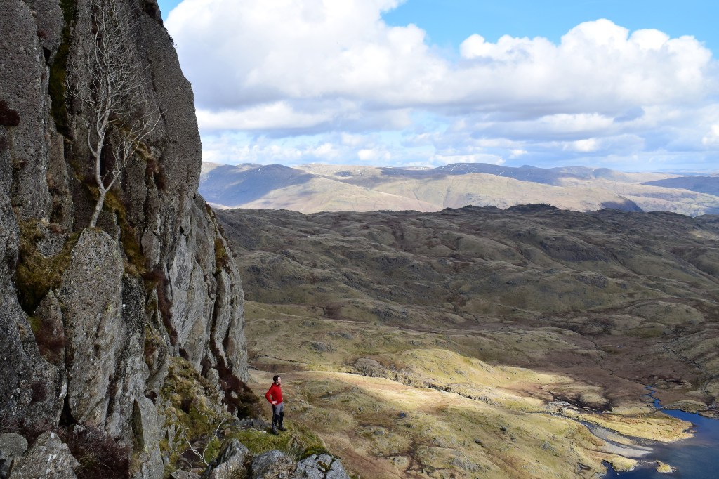
Looking up Jack’s Rake from start of scramble. Credit: James Forrest
It is a quirk of Lakeland that Pavey Ark – a fearsome cliff rising vertically out of Stickle Tarn into the Langdale Pikes skyline – can be climbed by the average hillwalker. How can this be possible? The answer is Jack’s Rake, a nerve-jangling (yet achievable) scramble up a rocky groove dissecting the precipitous crag. Guidebook writer Alfred Wainwright described it as “just about the limit that the ordinary fell walker may be expected to attempt”, with some “difficult and awkward” sections – but he also waxed lyrical about the rewards for those hikers brave enough to venture up the rake. “The humble walker is…afforded a rare opportunity to enter the realm of the climber, and the rock scenery is magnificent throughout.”
Jack’s Rack is a grade one scramble – a route that requires a degree of rock climbing, employing both hands and feet, without being technical. It is essentially an exposed walking route. But do not underestimate it. The scramble is an accident hotspot that has tragically claimed many lives. The rock is often greasy and wet, and in some places, the terrain is very exposed. Take it on, however, and you will be blessed with an adrenaline-inducing, memorable experience. You will scramble up a rocky groove, which mercifully shelters you from sheer precipices; haul yourself over rocky steps and up narrow chimneys; tiptoe along grassy terraces with dizzying views; and, ultimately, stand atop Pavey Ark feeling like a real adventurer. It might just be the only way to improve a near-perfect day of hill-walking in the Langdale Pikes.
Here is the detailed route description for Jack’s Rake, Pavey Ark.
2. Scafell Pike via Esk Hause
Scafell Pike may be the highest mountain in England, but there are better ways to get to it than slogging up and down the shortest route, argues Emily Woodhouse.
START/FINISH: Parking lay-by at Seathwaite (there may be extra field parking available in summer) | MAPS: OS Explorer OL4 & OL6 (1:25k), OS Landranger 90 Penrith and Keswick (1:50k), Harvey British Mountain Map Lake District (1:40k) | DISTANCE: 13.5km / 8.5miles | ASCENT: 950m / 3100ft | DURATION: 7 hours
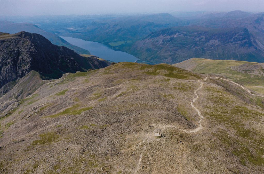
The summit of Scafell Pike via drone looking down on Wast Water. Credit: Shutterstock
So, you want to go up Scafell Pike to stand on the highest point in England, but you want to make a day of it on a full mountain outing that takes in more of the Lake District’s beautiful fells. You’re not scared of doubling the amount of distance you must walking uphill to get there – in fact, that sounds like your idea of fun. I have heard this route described as a monster. Personally, I find it a very pleasant day out – albeit long – which happens to take in Scafell Pike.
If your only objective is to stand on the highest summit in England then there are far more straightforward ways to do it. But if you want ridges, gullies, gills, tarns then look no further than the Corridor Route. As this is a very full day out, it’s important to start early to provide as much chance as possible to complete it in daylight. Although much of the route is on a clear path, it is easy to lose the cairns between Esk Hause and Scafell Pike in bad weather.
Here is the detailed route description for Scafell Pike via Esk Hause.
3. The Gatesgarth Round
Vivienne Crow joins the tops together for a western round which won’t appear on the usual lists: The Gatesgarth Round.
START/FINISH: Lake District pay-and-display car park in Buttermere village, GR NY173169 | MAPS: OS Explorer OL4 (1:25k), OS Landranger 89 (1:50k), Harvey 1:25,000 Superwalker Lake District North | DISTANCE: 15.6km/9.7 miles | ASCENT: 1226m/4021ft | DURATION: 6-7 hours
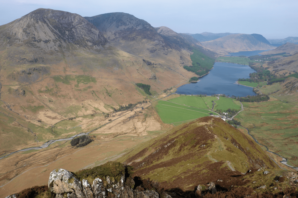
From Fleetwith Edge, looking down to Buttermere and across to the High Stile range. Credit: Vivienne Crow
This route might not be on any lists of classic Lakeland rounds, but it takes in the ridges on both sides of Gatesgarthdale, so I reckon it qualifies. Horseshoe or not, it’s a cracking walk. So, Gatesgarthdale? Well, that’s the rugged little side valley you drive through on descending from Honister Pass to Buttermere. As impressive as it looks from the road, it’s far better when seen from the fells… First tackle Fleetwith Edge, a series of rocky steps broken by easier, grassy interludes on a shoulder rising almost directly from Buttermere’s shores.
Continue along the northern edge of Fleetwith Pike, high above the via ferrata, before dropping to Honister Pass. Hitting a road half-way through a fell walk might seem perverse, but it’s only a brief interruption. No sooner have your feet touched tarmac than you’re off again – climbing to Dale Head. Enjoying some of the most far-reaching outlooks in this part of the Lakes, including the Isle of Man on a clear day, a high and undulating ridge then leads to Robinson, the final summit of the day to complete this, surely one of the best Lake District walks.
Here is the detailed route description for the Gatesgarth Round.
4. The Dodds Round
Often dismissed as boring and grassy, this secret route up the little-known Fisher’s Wife’s Rake path brings out the best of eastern Dodds, says James Forrest.
START/FINISH: United Utilities car park in Legburthwaite, CA12 4TQ. (GR: NY317195) | MAPS: OS Explorer OL5 (1:25k), OS Landranger 90 (1:50k), Harvey UltraMap XT40 Lake District East (1:40k) | DISTANCE: 15.2km / 9.4 miles | ASCENT: 943m / 3,094ft | DURATION: 6 hours
Note: Fisher’s Wife’s Rake is not a graded scramble, but it encounters steep, rough and pathless ground. First-rate navigation skills are required to find and safely negotiate the rake.
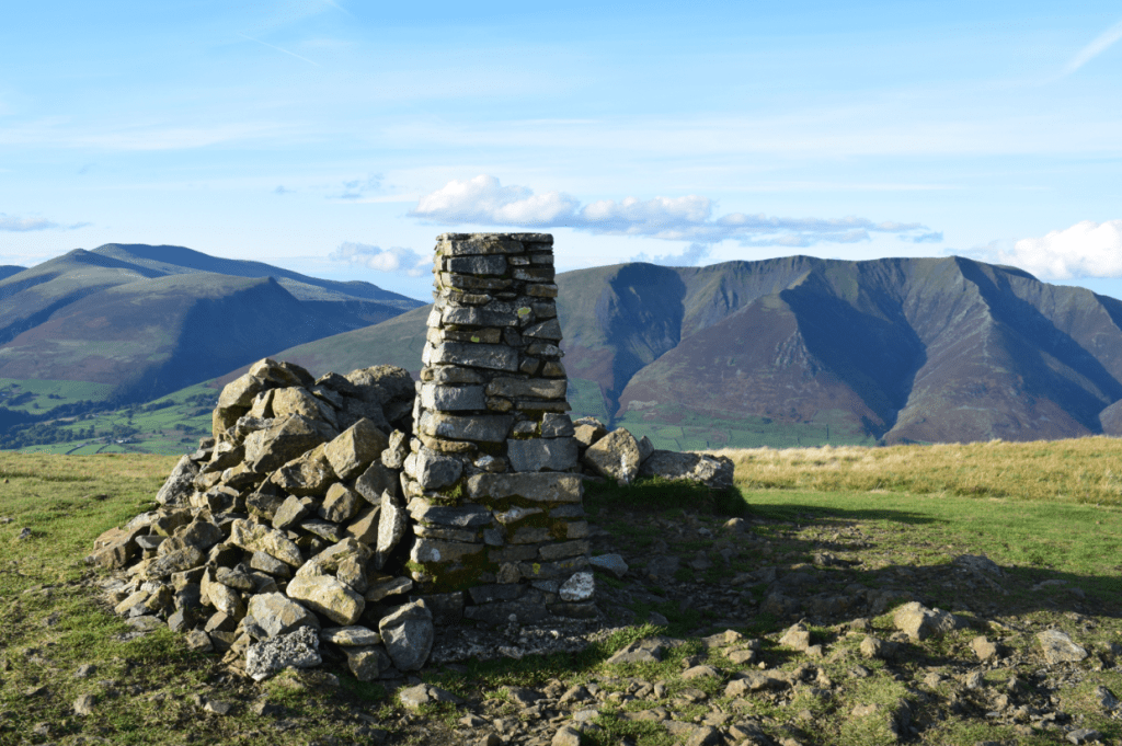
The Clough Head summit. Credit: James Forrest
At the northern end of the Helvellyn massif, in a patch of high land wedged between Thirlmere and Ullswater and bounded by the valleys of St John’s in the Vale, Threlkeld and Matterdale, lies a group of fells known collectively as the Dodds. Sometimes unjustly labelled as boring, grassy and rounded, this substantial high plateau should not be dismissed. While the eastern aspect is all grassy shoulders and rolling terrain, if you approach from the west, there is drama to be discovered in Castle Rock, Clough Head’s crags and – best of all – this secret ascent.
Fisher’s Wife Rake is a rough, steep and exciting climb, with a fascinating history. The Fisher family of St John’s in the Vale burnt peat to keep their cottage warm in the harsh 1800s. Mr Fisher’s job was cutting out slabs of peaty fuel from Clough Head’s summit; his wife’s unenviable role was to shuttle them up and down the mountain. The quickest route was a tilted, grassy rake through Wanthwaite Crags, and hence the trod was forever named after Mrs Fisher. Beyond the rake, our route continues southwards to bag Great Dodd, Watson’s Dodd and Stybarrow Dodd, before a looping return via Sticks Pass. It’s a far better option than a brutal up-and-down the rake – we’ll leave such hardship to the memory of that intrepid, peat-carrying woman of the 1800s.
Here is the detailed route description for the Dodds Round.
5. Skiddaw via Lingy Hut
Vivienne Crow enjoys solitude on an overnighter beyond Skiddaw bypassing the basic but secluded Lingy Hut.
START/FINISH: Moot Hall in Keswick town centre, GR NY266234 | MAPS: OS Explorer OL4 and OL5 (1:25k), OS Landranger 90 (1:50k), Harvey 1:25,000 Superwalker Lake District North | DISTANCE: 36km / 22.4 miles | ASCENT: 1,631m / 5,350ft | DURATION: 2 days
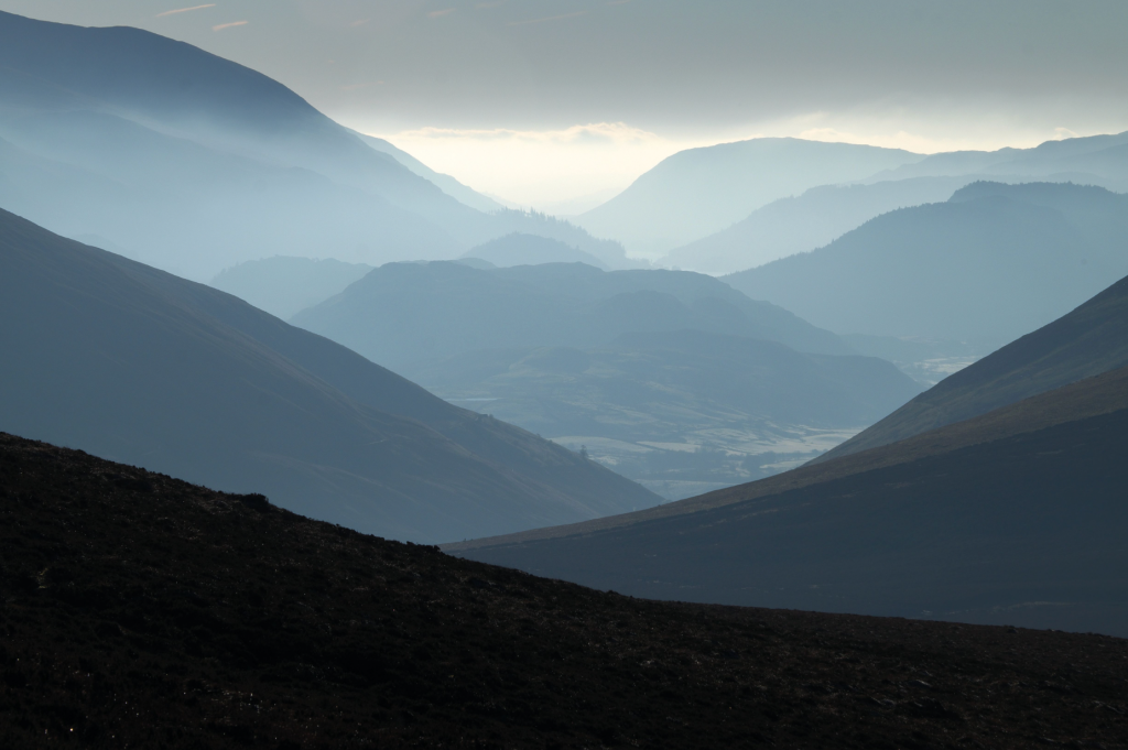
Looking south through the Glenderaterra gap from Great Calva. Credit: Vivienne Crow
Lingy Hut, sometimes also called Great Lingy Hut, is about as basic as bothies get. Little more than a large wooden shed, it contains a sleeping platform, a spade and a visitors’ book. But it sits in a wonderfully secluded spot, high up in the heart of the Lake District’s quiet Northern Fells. Starting from Keswick, this walk first climbs the busy ‘tourist path’ up Skiddaw before heading for the relative solitude of Great Calva and Knott, two peaks that feel like they’re an awfully long way from anywhere.
After an overnight stop at the hut, nearly 19km into the 36km route and 580m above sea level, the second day is easier. It follows the route of the Cumbria Way through the trench carved by the infant River Caldew and then leaves the fells via a balcony path clinging to the side of the Glenderaterra gap before rejoining the outward route to return to Keswick.
Here is the detailed route description for Skiddaw.
6. The Fusedale Round
The best ridge walk in Ullswater? It doesn’t have iconic status, but the Fusedale Round is a brilliant high-level loop, says James Forrest.
START/FINISH: Small car park at base of Hallin Fell (NY435192, postcode CA10 2NF) | MAPS: OS Explorer OL5 (1:25k), OS Landranger 90 (1:50k), Harvey UltraMap XT40 Lake District East (1:40k) | DISTANCE: 12.1km / 7.5 miles | ASCENT: 712m / 2,336ft | DURATION: 4.5 hours
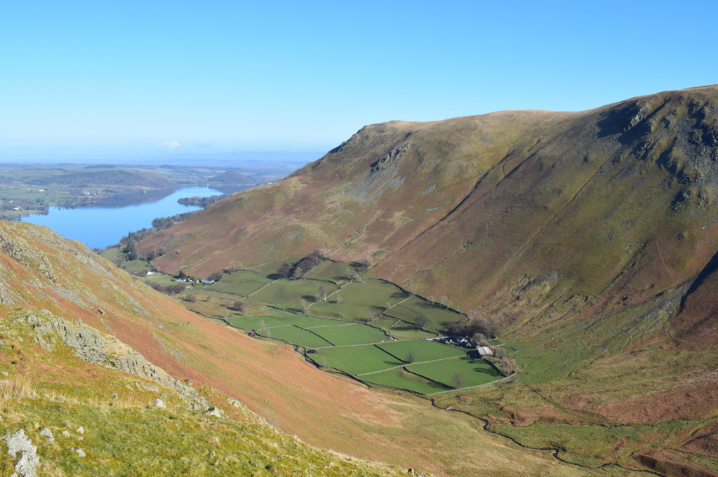
Fusedale valley with Steel Knotts to left and Bonscale Pike to the right, and Ullswater in the distance. Credit: James Forrest
“To walk upon these fells, to tramp the ridges, to look from their tops across miles of glorious country, is constant delight.” So wrote Alfred Wainwright in 1957 about his time exploring the Far Eastern Fells. One can only presume that – as he wrote these poetic words – he had in mind routes like this one. The Fusedale round is a high-level horseshoe ridge walk that delivers some true Ullswater magic. After all, Old Alf loved this area, describing Ullswater as “that loveliest of lakes, curving gracefully into the far distance”
It has a remote feel to it – quiet, understated and hidden. Yet this valley offers a delightful horseshoe ridge walk. The Fusedale Round bags five Wainwrights – Steel Knotts (Pikeawassa), Wether Hill, Loadpot Hill, Arthur’s Pike and Bonscale Pike – and completes a high-level loop of Fusedale Beck. While the higher peaks of Wether Hill and Loadpot Hill form a broad, grassy plateau of little interest, the smaller fells save the day. Steel Knotts has a statuesque rocky tor of acute sharpness crowning its summit, while Bonscale Pike and Arthur’s Pike serve up first-rate views over “that loveliest of lakes”. Is it the best ridge walk in the Ullswater area? It can’t be far off.
Here is the detailed route description for the Fusedale Round.
7. The Deepdale Horseshoe
Vivienne Crow strides out on Fairfield’s alternative round – the Deepdale Horseshoe.
START/FINISH: White Lion Inn, Patterdale, GR NY396158 | MAPS: OS Explorer OL5 (1:25k), OS Landranger 90 (1:50k), Harvey 1:25,000 Superwalker Lake District East | DISTANCE: 14.7km/9.1 miles | ASCENT: 1050m/3444ft | DURATION: 5½-6 hours
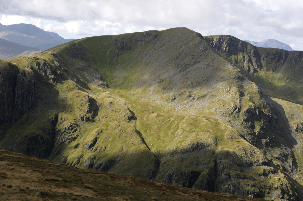
Looking across to Dollywaggon Pike from the Deepdale Hause ridge. Credit: Vivienne Crow
We’ve all heard of the Fairfield Round, haven’t we? But did you know that there’s another horseshoe that takes in Fairfield? Instead of using Ambleside as its base and approaching the 873m summit from the south, this one starts from Patterdale. It then heads south-west, climbing St Sunday Crag and Cofa Pike on the way up, briefly coinciding with the more popular round as far as Hart Crag and then descending via the long, bumpy ridge of Hartsop above How. I love the Deepdale Horseshoe.
I love the views across to the Helvellyn range from St Sunday Crag; I love the sometimes airy feel of the ridge linking St Sunday with Fairfield; I love peering down on the hidden coves and crags of Fairfield’s northern and eastern faces; and I love the ease of that final, grassy spur that Hart Crag throws out to the north-east. There’s grass, there’s rock, there’s scree. And then, of course, there’s the added bonus of a pub at the end of the day. What more could a hill-walker want from one of the best Lake District walks?
Here is the detailed route description for the Deepdale Horseshoe.
7. Blencathra via Sharp Edge and Hall’s Fell ridge
Ian Battersby waits for a good weather forecast to scramble both up and down Blencathra but remembers mountains make their own microclimate.
START/FINISH: Small layby on A66 just west of Scales; NY340268 | MAPS: OS Explorer OL5 (1:25k), OS Landranger 90 (1:50k), Harvey British Mountain Map Lake District (1:40k) | DISTANCE: 7.6km / 4.7 miles | ASCENT: 750m / 2,460ft | DURATION: 4.5 hours
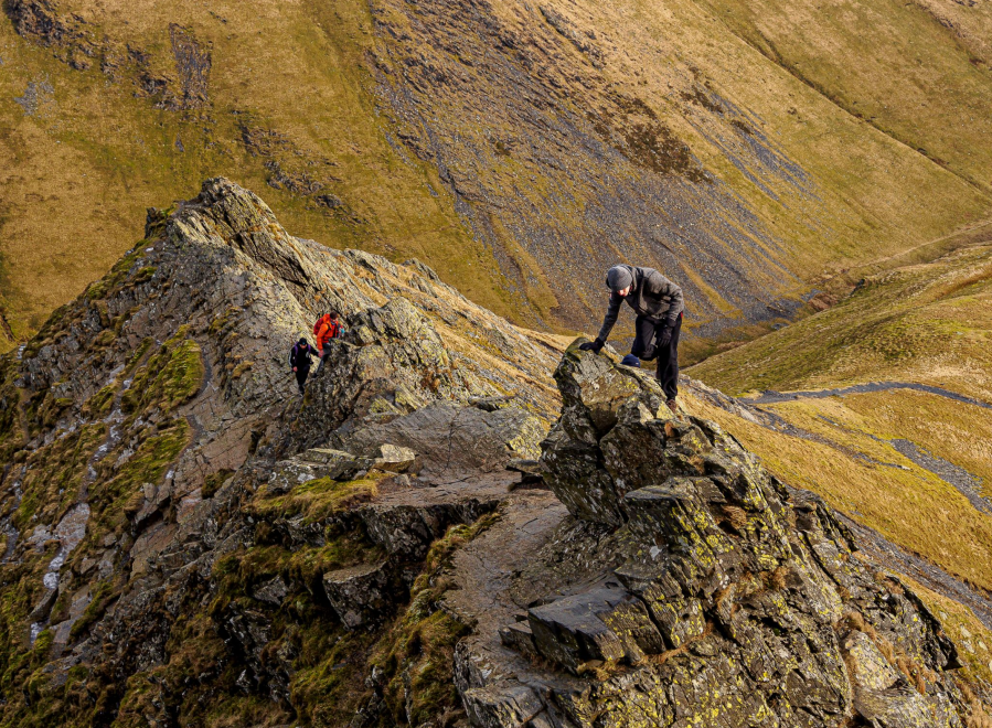
Scrambling across Sharp Edge. Credit: Ian Battersby
Blencathra is an awe-inspiring peak, much-loved among many, not least because it is home to not one, but two of Lakeland’s most sought-after grade 1 scrambles. This popularity – it often shows up on lists of the best Lake District walks – brings additional problems for the scrambler. You may not be alone, and if having the pressure of more confident scramblers behind you is not to your liking an early start is recommended.
Secondly, the rock has been polished smooth by the passage of countless boots (and bums) in the narrowest and therefore most hazardous areas. This affects both scrambles, but Sharp Edge in particular is best avoided in the wet. Windy weather also presents a danger on these exposed ridges, and Blencathra is known for generating its own wind defences in an otherwise calm forecast. There are nearby alternative routes up Blencathra if this proves to be the case, but otherwise, prepare for one of the Lake District’s most prized adventures.
Here is the detailed route description for Blencathra via Sharp Edge and Hall’s Fell Ridge.
8. Pillar Rock via the Shamrock Traverse
Want to gaze over Lakeland’s most handsome crag? This adventurous hike’n’scramble via the High Level Route and Shamrock Traverse is the finest way to experience Pillar Rock, says James Forrest.
START/FINISH: Gatesgarth Farm pay and display car park (NY194149) | MAPS: OS Explorer OL04 (1:25k), OS Landranger 89 (1:50k), Harvey British Mountain Map Lake District (1:40k) | DISTANCE: 13.9km / 8.6 miles | ASCENT: 1,395m / 4,577ft | DURATION: 6 hours
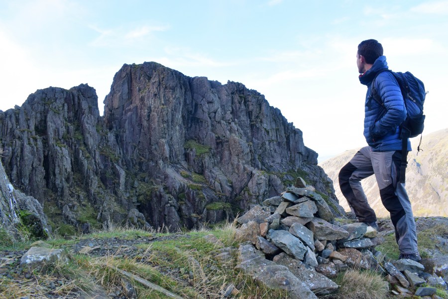
Gazing out over Pillar Rock with Pisgah and Jordan Gap clearly visible. Credit: James Forrest
Alfred Wainwright described this adrenaline-inducing scramble up Pillar from Buttermere as a “glorious walk…for strong walkers only”. Does that make it one of the hardest but best Lake District walks? A trio of passes – twice up Scarth Gap and once up Black Sail Pass – are to blame for the exertion, but the reward is worth the graft. You’ll get up close and personal with Pillar Rock – a seemingly impenetrable tower of rock that juts out of Pillar’s north face like a dark, craggy cathedral. The summit of Pillar Rock is the preserve of rock climbers, but this route enables hillwalkers to get close to the action. From its start, west of Looking Stead, the High Level Route is a rough trod over rugged terrain via Robinson’s Cairn, while the Shamrock Traverse is a tilted rake featuring a heart-in-mouth shuffle across a slab of rock with precipitous drops on one side.
It’s a tricky walk with some exposure and sections of rocky scrambling. Losing the trod could be fatal. But nowhere is it technically difficult and the views of Pillar Rock are something to behold.
Here is the detailed route description for the Shamrock Traverse.
9. Yewbarrow, Lake District
A simple slice of starter spice can be found just east of the Scafells beyond the Great Door to Yewbarrow, says Francesca Donovan.
Start/finish: Overbeck Bridge car park (GR: NY 167 068) | Distance: 4 miles/6.4km | Duration: 3 to 4 hours | Ascent: 601m/1,972ft | Maps: OS Explorer OL7 – English Lakes, South Eastern area (1:25k)
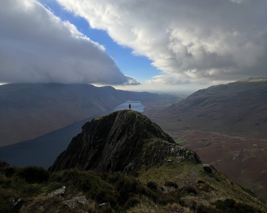
Looking southwest beyond Bell Rib to Wast Water. Credit: Francesca Donovan
Yewbarrow is your best bet for a taste of starter spice above Wast Water. Sandwiched between adrenaline-pumping Pillar to the north and lofty Lord’s Rake to the east, this fell offers easier navigation and docile rambling to bookend your short but sweet time on rock. Yet, Dropping Crag and the optional Bell Rig jaunt offer good grade 1 scrambling before you plod along the plateau of Yewbarrow, so called for its resemblance to an upturned boat hull, saying hello to Herdwicks who found their own route up. After the nursery slopes, the excitement begins at Great Door. Put the poles away and push yourself up.
If this ascent is plenty, the route gives an escape route west off Yewbarrow for those avoiding the scramble down Stirrup Crag. (But, if you’re up to it, expansive views of the Scafells await you on breaks to catch your breath.) Returning along the falls of Over Beck offers the perfect opportunity to plunge and de-spice before heading to the pub, making it one of the best Lake District walks.
Here is the detailed route description for Yewbarrow.
Read more: If you’re looking for routes beyond the best Lake District walks, explore the lesser-trodden walks in Eryri/Snowdonia, enjoy other overnighters in Britain’s best bothies or have one for the road on one of Lakeland’s excellent pub walks.

