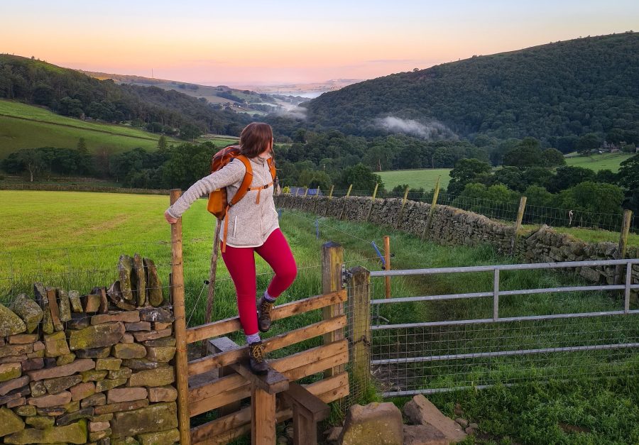
Arguably, there aren’t many hidden walks in the Peak District left. Britain’s first national park is compact, and home to communities and visitors who revel in yomping up hills and down dales. It’s also surrounded by cities, and hence very accessible to places a lot of people live – around 20 million people are estimated to live within an hour’s drive of the region.
Words: Francesca Donovan | Main image: Francesca Donovan
So, while you may come across other walkers on these routes, they are less well-trodden than the honeypot places where crowds commune. Please respect the environment and the local communities by ensuring you leave no trace on your Peak District walks. Likewise, always make sure to have good navigational skills and plan your own route according to your skills and ability.
Lesser-trodden walks in the Peak District
- Coombs Dale
- Margery Hill and Outer Edge
- Lantern Pike
- Axe Edge Moor
- Ramshaw Rocks
- Gun
- Wild Bank
- Chew Valley and Wimberry Crags
- South Head and Chinley Churn
1. Coombs Dale
Start/finish: Eyam free car park | Maps: OS Explorer OL1 – The Peak District, Dark Peak (1:25k scale) | Distance: 9.2 miles/14.8km | Ascent: 1,175ft/358m | Duration: 5 to 6 hours | Transport: Bus service 65 between Sheffield and Buxton stops in Eyam
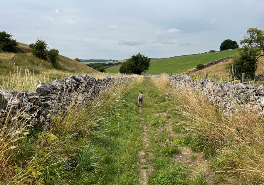
Walking through Coombs Dale in the Peak District.
Credit: Francesca Donovan
Unlike its crowded counterparts, Monsal and Millers Dale, Coombs Dale is much quieter. This is probably because of the lack of panoramic views and peaks offered elsewhere at the likes of Monsal Head, but this doesn’t make the walking any less enjoyable or the dale any less charming. You could quite easily imagine yourself to be walking through the Yorkshire Dales on a quiet ramble here.
2. Margery Hill and Outer Edge
Start/finish: Langsett reservoir car park | Maps: OS Explorer OL1 – The Peak District, Dark Peak (1:25k scale) | Distance: 10.6 miles/17km | Ascent: 1,075ft/328m | Duration: 5 to 6 hours | Transport: None to start
The name Outer Edge might conjure up a place worlds apart from The Peak. In fact, Outer Edge and Margery Hill are just a few miles up from Langsett reservoir. Yet, they offer big skies and rolling hills. Each time I’ve walked this area, I’ve come across maybe one or two others. Not bad, considering the popular route to Back Tor and Lost Lad lie just south of here.
3. Lantern Pike
Start/finish: Sett Valley Trail car park | Maps: OS Explorer OL1 – The Peak District, Dark Peak (1:25k scale) | Distance: 9.2 miles/14.8km | Ascent: 1,475ft/450m | Duration: 5 to 6 hours | Transport: The 61 High Peak bus from Buxton to Glossop stops at the Sett Valley Trail car park
While you’re unlikely to find Lantern Pike devoid of other walkers, the views are as rewarding as its neighboring vistas from the Kinder plateau despite the lesser elevation. A 10-mile circular also takes in Harry Hut and Mill Hill, just bypassing the bust William Clough, one of the most popular routes up to Kinder. The icing on this fine, quieter walk is the friendly pub of the same name that awaits you at the bottom – head out back to the beer garden at The Lantern Pike Inn for great views.
4. Axe Edge Moor
Start/finish: Layby parking on A54 | Maps: OS Explorer OL24 – The Peak District, White Peak (1:25k scale) | Distance: 10 miles/16.2km | Ascent: 1,325ft/404m | Duration: 5 to 6 hours | Transport: None to start
The moorland above Buxton offers some quieter walking – if you discount the busy thoroughfare of the Cat and Fiddle road and this route’s bypass over Three Shires Head, skirting popular spots such as Shining Tor, it sticks to the Whetstone Ridge, and Axe Edge Moor. From the latter, you can spot the unique peaks of Chrome and Parkhour Hills – sometimes called the Dragon’s Back – in the near distance on a clear day.
5. Ramshaw Rocks
Start/finish: Layby parking on Roaches Road | Maps: OS Explorer OL24 – The Peak District, White Peak (1:25k scale) | Distance: 7 miles/11.1km | Ascent: 1,100ft/335m | Duration: 4 to 5 hours | Transport: None to start
The little brother of The Roaches and Hen Cloud, Ramshaw Rocks offers a fine alternative and a great spot to watch the sunrise away from the crowds. There’s good clambering to be had on these outcrops above Black Brook Nature Reserve, with views over to the Mermaid’s Pool and Merryton Low.
While you’re in the area, all three sites make a good 7-mile walking route and if you get there early enough, you may well miss the crowds on The Roaches.
6. Gun
Start/finish: Roadside parking in Danebridge | Maps: OS Explorer OL24 – The Peak District, White Peak (1:25k scale) | Distance: 7.7 miles/12.5km | Ascent: 800ft/244m | Duration: 4 to 5 hours | Transport: None to start

The trig point at Gun. Credit: Francesca Donovan
This small but well-formed hill is also the site of a triangulation pillar – and some peace and quiet besides the dog walkers and bird watchers. Despite great views to the west, with minimal effort required, it’s relatively unknown among visitors to The Peak. If you start from Danebridge, your route will cross pretty weirs, natural pools and a particularly fantastic pub called The Ship, just up the hill into Wincle.
7. Wild Bank
Start/finish: Stalybridge train station | Maps: OS Explorer OL1 – The Peak District, Dark Peak (1:25k scale) | Distance: 8.4 miles/13.5km | Ascent: 1,150ft/351m | Duration: 4 to 5 hours | Transport: Trains to Stalybridge run hourly from Manchester
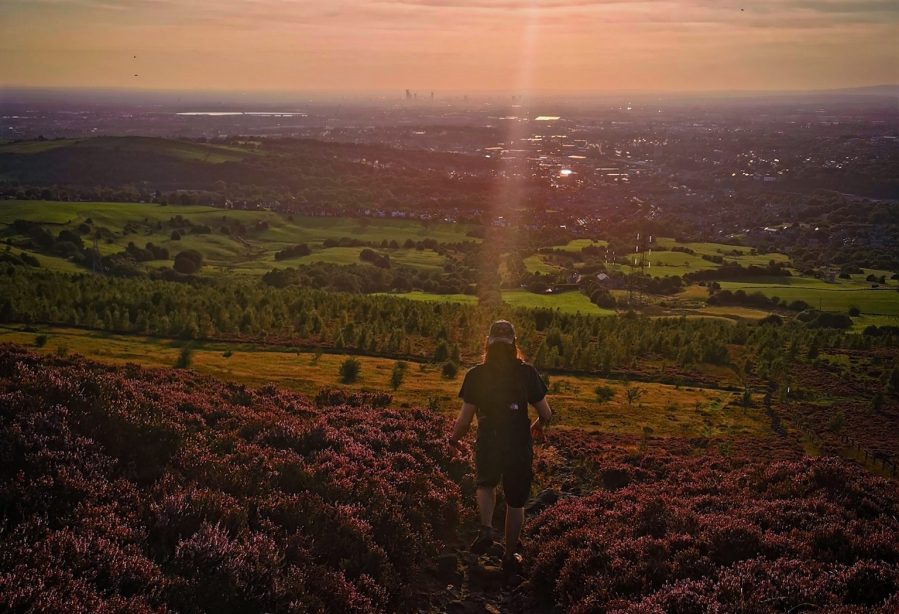
Wild Bank at sunset.
Credit: Francesca Donovan
This charming little hill – admittedly a stone’s throw outside of the Peak District boundary – offers a quiet spot to watch the sunset over Manchester, perched above Hollingworthhall Moor to the east, Swineshaw to the north, and Stalybrige to the west. While the moors are peppered with human intervention in the way of reservoirs, you’ll hike just about high enough to feel above it all here. Best of all, it’s very accessible by train from Manchester.
8. Chew Valley and Wimberry Crags
Start/finish: Dovestone Reservoir car park | Maps: OS Explorer OL1 – The Peak District, Dark Peak (1:25k scale) | Distance: 6.9 miles/11.1km | Ascent: 1,025ft/312m | Duration: 4 to 5 hours | Transport: None to start
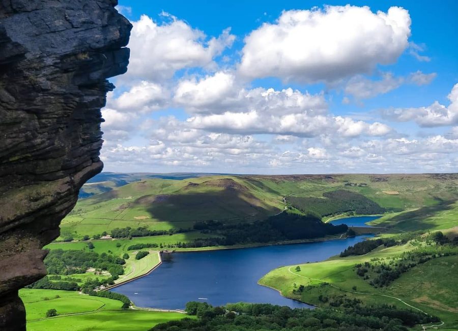
The view from Wimberry Crag down to Dovestone Reservoir. Credit: Francesca Donovan
When you arrive at the starting point of this walk – the bottom of Dovestone reservoir – you might wonder why this walk made the list. Indeed, the Dovestone circular, boasting Birchen Clough and The Trinnacle, is one of the most popular days out in the Peak District. However, head southwestwards to Chew Reservoir and you’ll escape the crowds (mostly).
While Chew offers a windswept aspect, it’s the ramble along Wimberry Crags – excellent examples of gritstone formations – and down to Alphin Pike that will give you some peace and quiet as you admire views across to Manchester and over the valley down to Dovestones.
9. South Head, Mount Famine and Chinley Churn
Start/finish: Chinley train station | Maps: OS Explorer OL1 – The Peak District, Dark Peak (1:25k scale) | Distance: 8.5 miles/13.6km | Ascent: 1,275ft/389m | Duration: 5 to 6 hours | Transport: Trains run to Chinley station from Manchester hourly
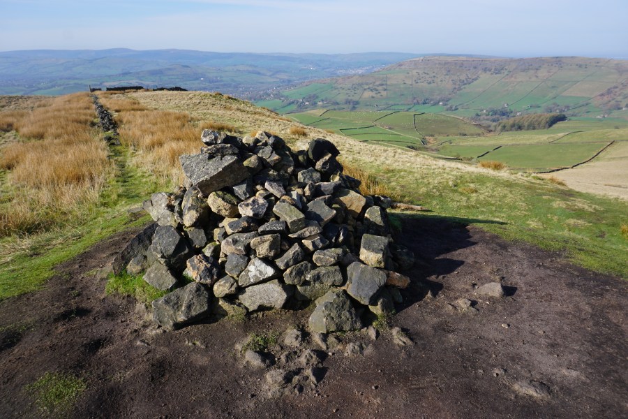
The cairn on South Head. Credit: Francesca Donovan
Just over the valley from Edale are the towns of Chinley and Chapel-en-le-Frith. From the former, you can wander up to Cracken Edge and Chinley Churn. Mostly frequented by local walkers, these high places are less loved than the Kinder Plateau onto which they lead. They are some of the best hidden walks in the Peak District. They’re also just as accessible by train from Manchester and Sheffield as popular Edale walks.
If you’re looking for a classic Peak District walk along big trails populated by pub-seekers, dog walkers and hikers alike, check out our best family-friendly walks in the Peak District or waterfall walks in the Peak District. For more information go to peakdistrict.gov.uk.
If you’re looking for mountainous adventures, why not head for one of the six best routes in Eryri (Snowdonia)? The national park in the north of Wales lies a few hours from Manchester and there are plenty of high places where one can seek solitude on a grander scale than these hidden walks in the Peak District.

