This Clachaig circuit in the Bidean nam Bian range gets all the best views, and is great in winter, says Alex Roddie.
I’ll never forget the first time I climbed Bidean nam Bian in winter, striding along that snowy crest. Stob Coire nan Lochan is another perennial favourite. However, Bidean’s other close neighbour, Stob Coire Sgreamhach, has a somewhat aloof vibe – it wasn’t even recognised as a Munro until 1997, and getting to the top requires a bit more effort than an ascent of Bidean.
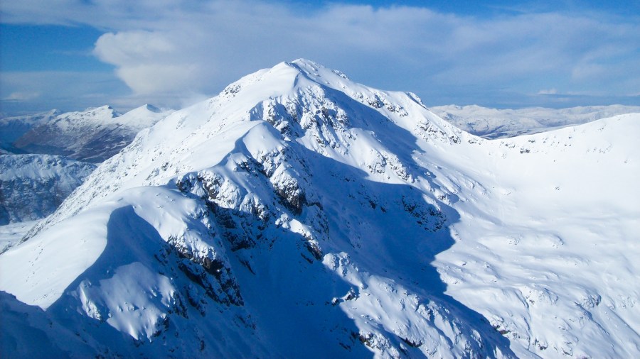
However, it is so worthwhile. Especially in winter, when this mountain takes on the atmosphere of a towering Himalayan or Alpine giant (think I’m exaggerating? Just go and look for yourself!) It’s not an easy climb from any side, with even the normal approach up the gorgeous Lost Valley involving a steep snow slope verging on Grade I. It’s best avoided if you aren’t competent with ice axe and crampons. And check the avalanche forecast beforehand (sais.gov.uk).
However, if you have the skills, this long day out, starting and finishing at the Clachaig, is one of the best in the West Highlands. You’ll particularly enjoy the amphitheatre of Coir Eilde on the descent.
Stob Coire Sgreamhach via Coire Gabhail (the Lost Valley) and The Clachaig Inn: route description
START/FINISH: NN128567 Clachaig Inn, Glen Coe | MAPS: OS 1:25,000 Explorer sheet 384 (Glen Coe & Glen Etive), OS 1:50,000 Landranger sheet 41 (Ben Nevis), Harvey 1:40,000 British Mountain Map (Ben Nevis & Glen Coe) | DISTANCE: 22.6km / 14 miles | ASCENT: 1,069m / 3,507ft | DURATION: 9 to 12 hours
1. NN128567: Starting from the Clachaig, turn right and head SE along the minor road converging with the A82. Cross the A82 after 1km and enter the parking area on the other side. At the far end of the car park, a path heads right of the barrier. Keep following this track, which hugs the A82 in places and diverges from it in others. Ignore the fork heading S towards Coire nan Lochan after 4.5km; instead the track climbs slightly before descending, 5km from the start, to a footbridge across the River Coe, signposted for the Lost Valley.

The famous cottage of Achnambeithach. Credit: Alex Roddie
2. NN173564: Cross the footbridge and follow the path, which begins climbing steeply through birch woodland. The trail heads uphill towards the deep V-notch of Coire Gabhail. The path soon plunges back into gnarled birch woodland amongst huge boulders. Cross the burn on stepping stones after just under 1km, and then ascend about 50m elevation to arrive at a prominence with spectacular views deeper into the valley. The obvious triangular peak left of the valley head is Stob Coire Sgreamhach.
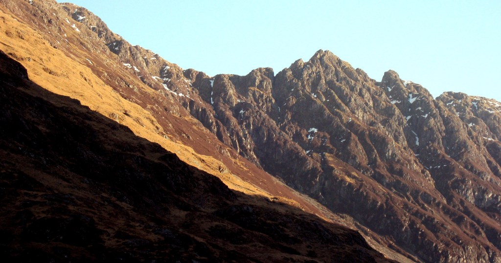
The Aonach Eagach frames the northern side of Glen Coe. Credit: Alex Roddie
3. NN168555: Descend slightly towards the flat rocky meadow in the heart of the corrie. According to folklore, this is where stolen cattle were once concealed; it also makes a great camping spot. Cross the flat valley floor, then trend right when the terrain begins steepening again; the onward path is obvious where it begins climbing more steeply uphill on the N bank of Allt Coire Gabhail (which is soon enclosed in a steep gorge).
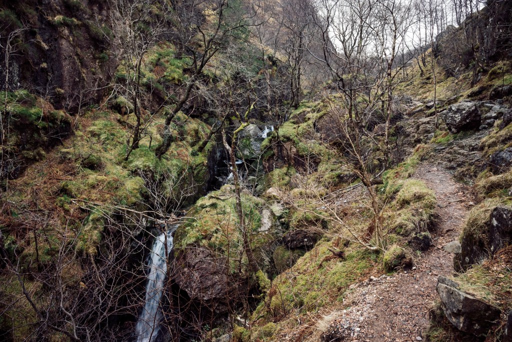
The impressive gorge of the Lost Valley. Credit: Alex Roddie
4. NN162551: The path now climbs steadily for just over 1km, gaining around 250m of elevation until the terrain begins to steepen further.
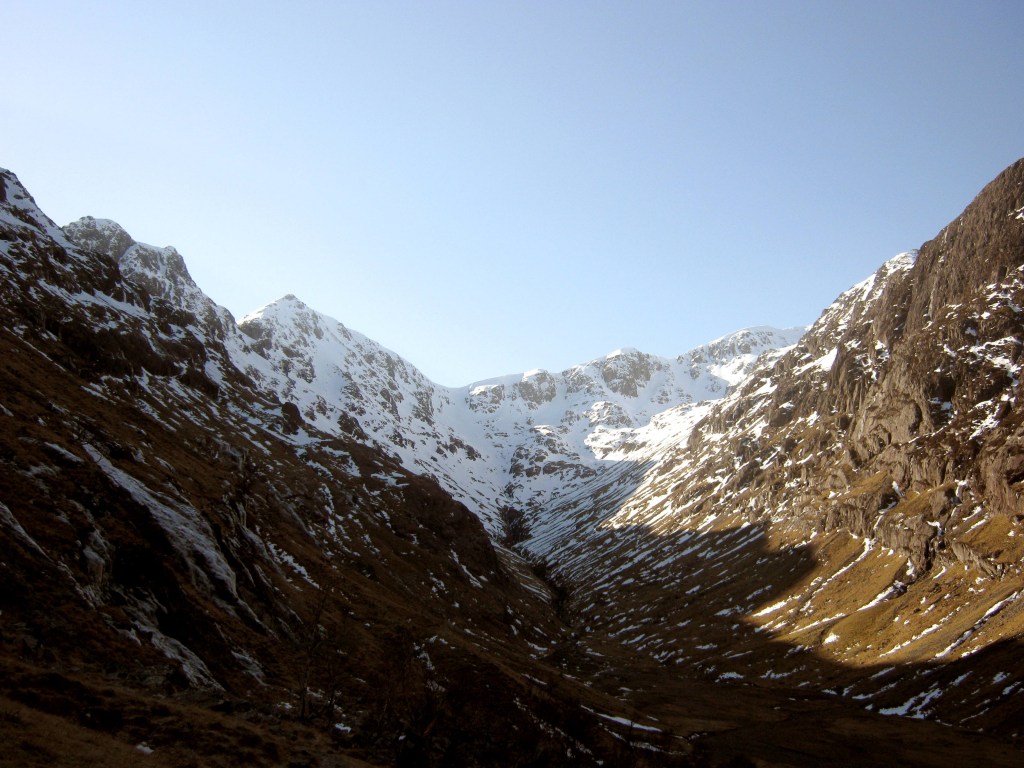
The famous view of the Lost Valley’s head in vintage winter conditions. Credit: Alex Roddie
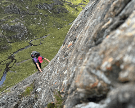
5. NN153541: There’s a short, steep, scrambly ascent up wet ground (which often ices over) between crags. In an average winter the path often disappears under snow above this point, but in summer eroded and loose scree leads (very steeply) all the way to Bealach Dearg at 944m. In winter, after assessing the slope for safety begin climbing towards the bealach, trending left of technical craggy ground. The easiest line is usually slightly right of the central chute, but adapt to the conditions as you find them. There may be a cornice but it has usually been cut by prior parties.
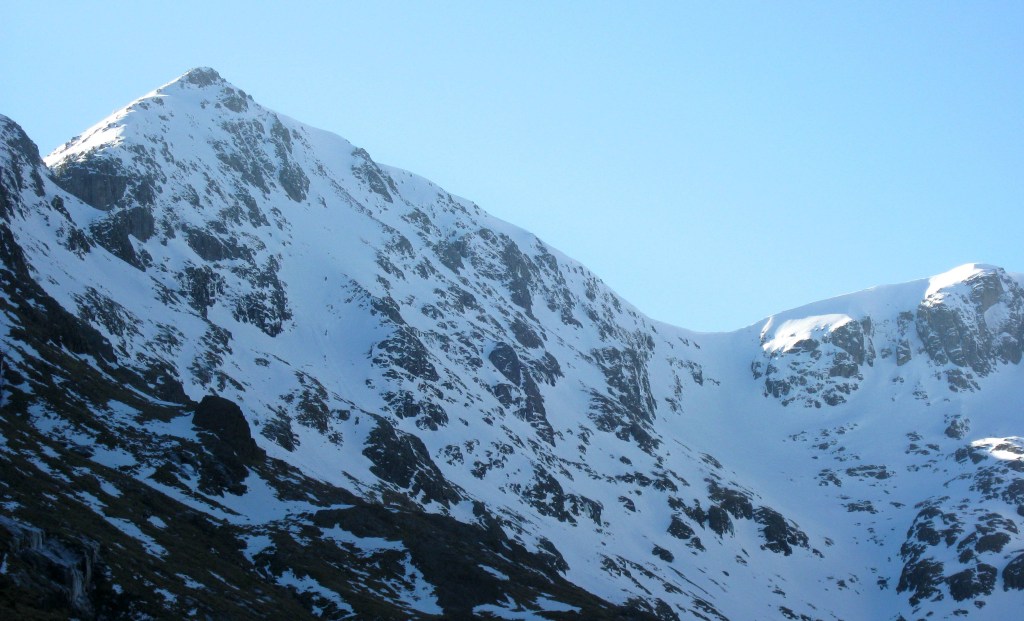
A closer view of the headwall, Stob Coire Sgreamhach looming above. Credit: Alex Roddie
6. NN151537: Bealach Dearg can be a windy spot. Turn left and begin climbing the short, steep W Ridge of Stob Coire Sgreamhach.
7. NN155537: Soon arrive at the 1,072m summit. The views back towards Bidean nam Bian, as well as NE towards Beinn Fhada, are stupendous. To descend, head first due S and then SE, following the comparatively broad and gentle SE ridge.
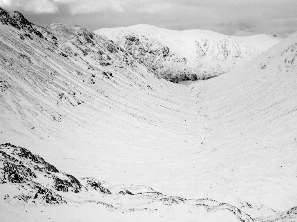
Descending the Lairig Eilde. Credit: Alex Roddie
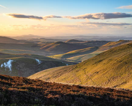
8. NN164528: After descending 331m of elevation, to an unnamed 741m bealach just before a small prominence, there is a safe descent heading NE into the Lairig Eilde. This can be hard to find from the top – don’t try to descend steep ground before you get to the bealach. Descend NE, taking care to avoid veering too far E into a gully, to reach the broad bealach (489m) at the head of Lairig Eilde.
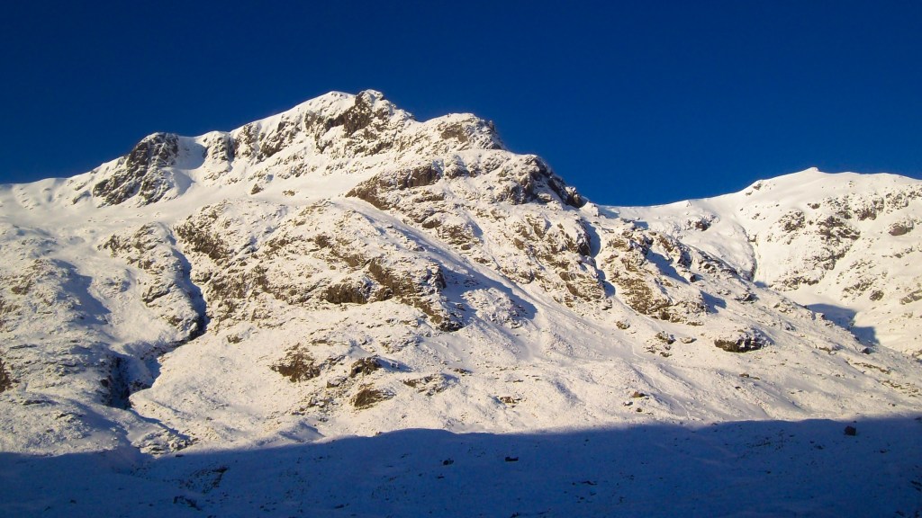
In the Lairig Eilde, looking back up towards the Sron na Lairig ridge. Credit: Alex Roddie
9. NN170534: Cross soft ground to reach the main Lairig Eilde path, which is very boggy in places. Follow it N for just over 3km to reach the car park on the A82.
10. NN188563: Cross the road and climb briefly to join a track; turn left and follow it past the ruined Allt-na-ruigh. Here cross the road and descend back to the junction with the Lost Valley path. Retrace your earlier steps back to the Clachaig.
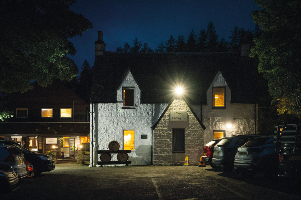
After dark at the Clachaig. Credit: Alex Roddie
Further information
PUBLIC TRANSPORT: Scottish Citylink 915 coach to Glencoe village from Glasgow or Fort William; ask to be let off for the Clachaig
TOURIST INFORMATION: discoverglencoe.scot or visitscotland.com
Discover more peak-to-pub walks as mapped by our expert contributors.

